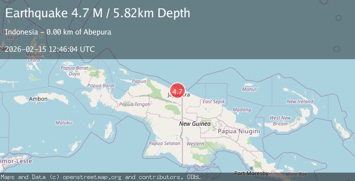
Earthquake Near North Coast of West Papua
Sun, 15 Feb 2026 12:46:04 GMT
Time3 days ago
Location
-2.5959, 140.6226
Depth
5.8 KM
Event Summary
A 4.7 magnitude earthquake struck on Near North Coast of West Papua, at Sun, 15 Feb 2026 12:46:04 GMT. Depth: 5.824214km. Reviewed by BMKG seismologists, this light quake occurred at a magnitude type of M.
Magnitude
4.7
M
Source
BMKG
Intensity
-
Agency Reports
1 Sources| Source | Magnitude | Depth | Time |
|---|---|---|---|
| BMKGPrimary | 4.7 | 6 km | 3 days ago |
Earthquake Details
ManualEvent IDbmg2026dfex
Tsunami PotentialNo
Magnitude TypeM
Nearest Places
- Abepura1.1 km
- Kelurahan Waena1.1 km
- Kampung Waena1.5 km
- Distrik Heram1.6 km
- Kampung Yoka2.3 km
Comments
Join the discussion about this event.
Latest Earthquakes
1.8Mag
Western Australia
Time12 hours ago
Depth0.00 km
SourceVYT (Automatic)
2.3Mag
Southern Sumatra, Indonesia
Time12 hours ago
Depth6.29 km
SourceBMKG
3.2Mag
OFF W. COAST OF S. ISLAND, N.Z.
Time12 hours ago
Depth10.00 km
SourceGNS (Automatic)
1.9Mag
Tarapaca, Chile
Time12 hours ago
Depth109.74 km
SourceVYT (Automatic)
2.1Mag
Ceram Sea
Time12 hours ago
Depth10.00 km
SourceBMKG
Nearby Earthquakes
2.2Mag
Near North Coast of West Papua
Time3 weeks ago
Depth30.05 km
SourceBMKG (Automatic)
5.1Mag
NEAR N COAST OF PAPUA, INDONESIA
Time3 years ago
Depth10.00 km
SourceEMSC (Automatic)
3.0Mag
NEAR N COAST OF PAPUA, INDONESIA
Time2 years ago
Depth10.00 km
SourceBMKG (Automatic)
4.0Mag
NEAR N COAST OF PAPUA, INDONESIA
Time3 years ago
Depth10.00 km
SourceDJA (Automatic)
5.0Mag
NEAR N COAST OF PAPUA, INDONESIA
Time3 years ago
Depth10.00 km
SourceEMSC (Automatic)