Earthquake West Papua, Indonesia
Sun, 15 Feb 2026 18:33:47 GMT
Time3 days ago
Location
-3.0963, 140.4488
Depth
41.3 KM
Event Summary
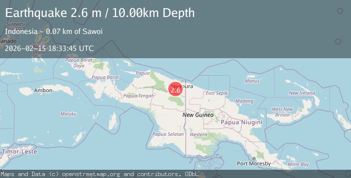
A 2.6 magnitude earthquake struck on West Papua, Indonesia, at Sun, 15 Feb 2026 18:33:47 GMT. Depth: 41.268608km. Reviewed by BMKG seismologists, this minor quake occurred at a magnitude type of M.
Magnitude
2.6
M
Source
BMKG
Intensity
-
Agency Reports
1 Sources| Source | Magnitude | Depth | Time |
|---|---|---|---|
| BMKGPrimary | 2.6 | 10 km | 3 days ago |
Earthquake Details
ManualEvent IDbmg2026dfqj
Tsunami PotentialNo
Magnitude TypeM
Nearest Places
- Samsi9.0 km
- Kampung Sawabuun13.7 km
- Yote21.5 km
- Kampung Sawanawa23.1 km
- Kampung Skanto23.3 km
Comments
Join the discussion about this event.
Latest Earthquakes
2.8Mag
Antofagasta, Chile
Time6 minutes ago
Depth0.00 km
SourceVYT (Automatic)
3.3Mag
Near North Coast of West Papua
Time7 minutes ago
Depth10.00 km
SourceBMKG
2.5Mag
off the coast of Tarapaca, Chile
Time8 minutes ago
Depth0.00 km
SourceVYT (Automatic)
2.6Mag
Sunda Strait, Indonesia
Time9 minutes ago
Depth8.74 km
SourceBMKG
2.8Mag
Ceram Sea
Time10 minutes ago
Depth5.46 km
SourceBMKG
Nearby Earthquakes
2.6Mag
West Papua, Indonesia
Time3 days ago
Depth10.00 km
SourceBMKG
2.8Mag
Near North Coast of West Papua
Time2 days ago
Depth10.00 km
SourceBMKG
3.0Mag
NEAR N COAST OF PAPUA, INDONESIA
Time5 years ago
Depth10.00 km
SourceDJA (Automatic)
2.6Mag
PAPUA, INDONESIA
Time1 month ago
Depth26.00 km
SourceBMKG (Automatic)
2.5Mag
West Papua, Indonesia
Time3 weeks ago
Depth10.00 km
SourceBMKG (Automatic)