Earthquake West Papua, Indonesia
Sun, 15 Feb 2026 06:09:31 GMT
Time3 days ago
Location
-3.0809, 140.4187
Depth
10.0 KM
Event Summary
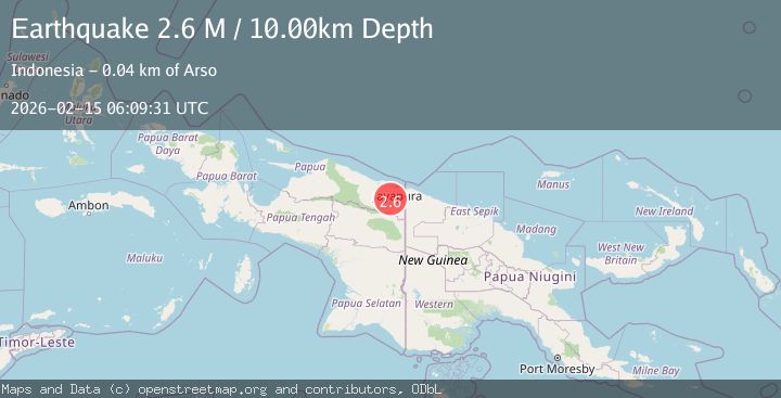
A 2.6 magnitude earthquake struck on West Papua, Indonesia, at Sun, 15 Feb 2026 06:09:31 GMT. Depth: 10km. Reviewed by BMKG seismologists, this minor quake occurred at a magnitude type of M.
Magnitude
2.6
M
Source
BMKG
Intensity
-
Agency Reports
1 Sources| Source | Magnitude | Depth | Time |
|---|---|---|---|
| BMKGPrimary | 2.6 | 10 km | 3 days ago |
Earthquake Details
ManualEvent IDbmg2026derv
Tsunami PotentialNo
Magnitude TypeM
Nearest Places
- Samsi10.5 km
- Kampung Sawabuun17.0 km
- Kampung Skanto22.4 km
- Kampung Kwarja22.5 km
- Yote23.8 km
Comments
Join the discussion about this event.
Latest Earthquakes
1.7Mag
Southern Alaska
Time17 hours ago
Depth2.44 km
SourceVYT (Automatic)
2.2Mag
Kodiak Island region, Alaska
Time17 hours ago
Depth30.52 km
SourceVYT (Automatic)
1.7Mag
9 km SE of Pearsall, Texas
Time17 hours ago
Depth7.54 km
SourceUSGS (Automatic)
3.9Mag
Flores region, Indonesia
Time17 hours ago
Depth176.39 km
SourceVYT (Automatic)
3.0Mag
near the coast of southern Peru
Time17 hours ago
Depth57.25 km
SourceVYT (Automatic)
Nearby Earthquakes
2.6Mag
West Papua, Indonesia
Time3 days ago
Depth41.27 km
SourceBMKG
2.8Mag
Near North Coast of West Papua
Time2 days ago
Depth10.00 km
SourceBMKG
3.0Mag
NEAR N COAST OF PAPUA, INDONESIA
Time5 years ago
Depth10.00 km
SourceDJA (Automatic)
2.5Mag
West Papua, Indonesia
Time3 weeks ago
Depth10.00 km
SourceBMKG (Automatic)
2.6Mag
PAPUA, INDONESIA
Time1 month ago
Depth26.00 km
SourceBMKG (Automatic)