Earthquake West Papua Region, Indonesia
Mon, 16 Feb 2026 01:07:55 GMT
Time3 days ago
Location
-3.4137, 131.0866
Depth
53.7 KM
Event Summary
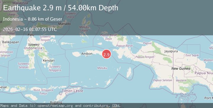
A 2.9 magnitude earthquake struck on West Papua Region, Indonesia, at Mon, 16 Feb 2026 01:07:55 GMT. Depth: 53.689137km. Reviewed by BMKG seismologists, this minor quake occurred at a magnitude type of M.
Magnitude
2.9
M
Source
BMKG
Intensity
-
Agency Reports
1 Sources| Source | Magnitude | Depth | Time |
|---|---|---|---|
| BMKGPrimary | 2.9 | 54 km | 3 days ago |
Earthquake Details
ManualEvent IDbmg2026dgdj
Tsunami PotentialNo
Magnitude TypeM
Nearest Places
- Pulau Madorang25.6 km
- Karang Urlah26.7 km
- Pulau Akat27.1 km
- Karang Ulin27.4 km
- Pulau Akat27.8 km
Comments
Join the discussion about this event.
Latest Earthquakes
2.3Mag
northwestern Russia
Time3 minutes ago
Depth0.00 km
SourceVYT (Automatic)
1.1Mag
7 km WSW of Corona, CA
Time3 minutes ago
Depth22.23 km
SourceUSGS (Automatic)
1.6Mag
60 km S of Whites City, New Mexico
Time5 minutes ago
Depth4.19 km
SourceUSGS (Automatic)
2.3Mag
Poland
Time10 minutes ago
Depth0.00 km
SourceVYT (Automatic)
2.5Mag
FRANCE
Time10 minutes ago
Depth5.00 km
SourceReNaSS (Automatic)
Nearby Earthquakes
2.9Mag
West Papua Region, Indonesia
Time3 weeks ago
Depth83.86 km
SourceBMKG (Automatic)
5.8Mag
CERAM SEA, INDONESIA
Time15 years ago
Depth8.00 km
SourceEMSC (Automatic)
5.3Mag
CERAM SEA, INDONESIA
Time5 years ago
Depth10.00 km
SourceEMSC (Automatic)
5.1Mag
CERAM SEA, INDONESIA
Time1 year ago
Depth10.00 km
SourceEMSC (Automatic)
5.3Mag
CERAM SEA, INDONESIA
Time13 years ago
Depth40.00 km
SourceEMSC (Automatic)