Earthquake CERAM SEA, INDONESIA
Mon, 02 Nov 2020 18:01:58 GMT
Time5 years ago
Location
-3.4500, 131.1000
Depth
10.0 KM
Event Summary
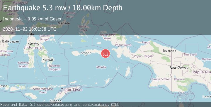
A 5.3 magnitude earthquake struck on CERAM SEA, INDONESIA, at Mon, 02 Nov 2020 18:01:58 GMT. Depth: 10km. Reviewed by EMSC seismologists, this moderate quake occurred at a magnitude type of mw.
Magnitude
5.3
mw
Source
EMSC
Intensity
-
Agency Reports
1 Sources| Source | Magnitude | Depth | Time |
|---|---|---|---|
| EMSCPrimary | 5.3 | 10 km | 5 years ago |
Earthquake Details
AutomaticEvent IDemsc_EMSC_20201102_0000240
Tsunami PotentialNo
Magnitude Typemw
Nearest Places
- Pulau Madorang21.8 km
- Pulau Akat26.8 km
- Karang Ulin27.2 km
- Pulau Akat27.6 km
- Karang Urlah27.8 km
Comments
Join the discussion about this event.
Latest Earthquakes
2.9Mag
Sumbawa Region, Indonesia
Time7 hours ago
Depth53.96 km
SourceBMKG
0.8Mag
Southern Alaska
Time7 hours ago
Depth15.50 km
SourceVYT (Automatic)
3.3Mag
Banda Sea
Time7 hours ago
Depth161.74 km
SourceVYT (Automatic)
4.4Mag
North of Halmahera, Indonesia
Time7 hours ago
Depth30.29 km
SourceBMKG
3.0Mag
Seram, Indonesia
Time7 hours ago
Depth3.59 km
SourceBMKG
Nearby Earthquakes
2.9Mag
West Papua Region, Indonesia
Time3 days ago
Depth53.69 km
SourceBMKG
2.9Mag
West Papua Region, Indonesia
Time3 weeks ago
Depth83.86 km
SourceBMKG (Automatic)
5.8Mag
CERAM SEA, INDONESIA
Time15 years ago
Depth8.00 km
SourceEMSC (Automatic)
5.3Mag
CERAM SEA, INDONESIA
Time13 years ago
Depth40.00 km
SourceEMSC (Automatic)
5.1Mag
CERAM SEA, INDONESIA
Time16 years ago
Depth30.00 km
SourceEMSC (Automatic)