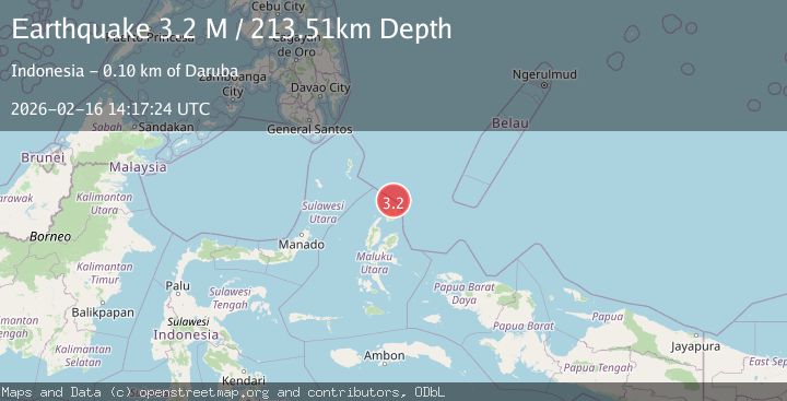
Earthquake Halmahera, Indonesia
Mon, 16 Feb 2026 14:17:24 GMT
Time2 days ago
Location
2.8912, 128.5538
Depth
213.5 KM
Event Summary
A 3.2 magnitude earthquake struck on Halmahera, Indonesia, at Mon, 16 Feb 2026 14:17:24 GMT. Depth: 213.508118km. Reviewed by BMKG seismologists, this minor quake occurred at a magnitude type of M.
Magnitude
3.2
M
Source
BMKG
Intensity
-
Agency Reports
1 Sources| Source | Magnitude | Depth | Time |
|---|---|---|---|
| BMKGPrimary | 3.2 | 214 km | 2 days ago |
Earthquake Details
ManualEvent IDbmg2026dhdl
Tsunami PotentialNo
Magnitude TypeM
Nearest Places
- Tanjung Sopi27.6 km
- Kakaibabao28.9 km
- Tanjung Modiu30.7 km
- Papuamalolu31.0 km
- Teluk Sopi33.0 km
Comments
Join the discussion about this event.
Latest Earthquakes
2.7Mag
Near North Coast of West Papua
Time1 hour ago
Depth45.06 km
SourceBMKG
1.2Mag
Central Alaska
Time1 hour ago
Depth0.85 km
SourceVYT (Automatic)
2.6Mag
West Papua Region, Indonesia
Time1 hour ago
Depth10.00 km
SourceBMKG
2.3Mag
WESTERN TURKEY
Time1 hour ago
Depth10.10 km
SourceKOERI (Automatic)
2.6Mag
Antofagasta, Chile
Time1 hour ago
Depth0.00 km
SourceVYT (Automatic)
Nearby Earthquakes
5.3Mag
HALMAHERA, INDONESIA
Time10 years ago
Depth201.00 km
SourceEMSC (Automatic)
5.0Mag
HALMAHERA, INDONESIA
Time19 years ago
Depth234.00 km
SourceEMSC (Automatic)
4.0Mag
HALMAHERA, INDONESIA
Time2 years ago
Depth211.00 km
SourceDJA (Automatic)
5.2Mag
HALMAHERA, INDONESIA
Time12 years ago
Depth214.00 km
SourceEMSC (Automatic)
4.0Mag
HALMAHERA, INDONESIA
Time3 years ago
Depth219.00 km
SourceDJA (Automatic)