Earthquake Minahassa Peninsula, Sulawesi
Mon, 16 Feb 2026 21:06:57 GMT
Time2 days ago
Location
-0.1301, 122.9269
Depth
112.7 KM
Event Summary
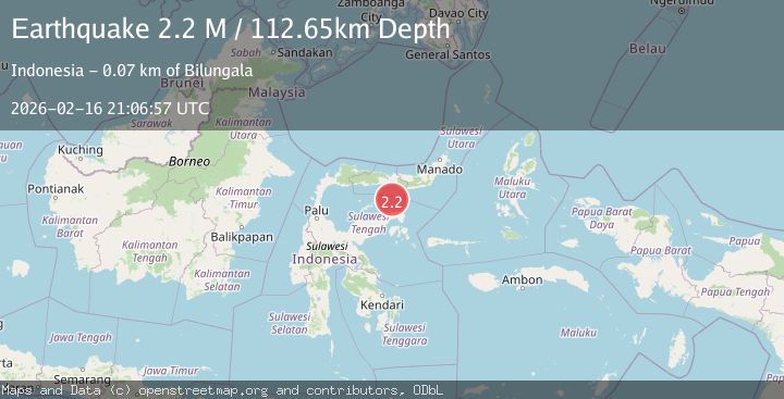
A 2.2 magnitude earthquake struck on Minahassa Peninsula, Sulawesi, at Mon, 16 Feb 2026 21:06:57 GMT. Depth: 112.652748km. Reviewed by BMKG seismologists, this minor quake occurred at a magnitude type of M.
Magnitude
2.2
M
Source
BMKG
Intensity
-
Agency Reports
1 Sources| Source | Magnitude | Depth | Time |
|---|---|---|---|
| BMKGPrimary | 2.2 | 113 km | 2 days ago |
Earthquake Details
ManualEvent IDbmg2026dhqy
Tsunami PotentialNo
Magnitude TypeM
Nearest Places
- Pulau Sendiri37.4 km
- Pulau Ban45.9 km
- Pulau Dondolang46.1 km
- Pulau Mantawalu Daka46.9 km
- Pulau Mantawalu Ise50.2 km
Comments
Join the discussion about this event.
Latest Earthquakes
0.6Mag
5 km WNW of Cobb, CA
Time17 hours ago
Depth1.21 km
SourceUSGS (Automatic)
1.3Mag
136 km SSE of McCarthy, Alaska
Time17 hours ago
Depth5.00 km
SourceUSGS (Automatic)
3.7Mag
offshore Coquimbo, Chile
Time17 hours ago
Depth0.00 km
SourceVYT (Automatic)
1.4Mag
EASTERN TURKEY
Time17 hours ago
Depth6.80 km
SourceAFAD (Automatic)
1.9Mag
6 km SW of Fuig, Puerto Rico
Time17 hours ago
Depth13.76 km
SourceUSGS
Nearby Earthquakes
2.5Mag
Minahassa Peninsula, Sulawesi
Time3 weeks ago
Depth29.65 km
SourceBMKG (Automatic)
3.0Mag
SULAWESI, INDONESIA
Time11 months ago
Depth28.00 km
SourceBMKG (Automatic)
3.0Mag
SULAWESI, INDONESIA
Time5 years ago
Depth33.00 km
SourceDJA (Automatic)
3.0Mag
SULAWESI, INDONESIA
Time3 months ago
Depth12.00 km
SourceBMKG (Automatic)
2.6Mag
Minahassa Peninsula, Sulawesi
Time2 weeks ago
Depth18.88 km
SourceBMKG (Automatic)