Earthquake Flores Sea
Tue, 17 Feb 2026 21:33:29 GMT
Time13 hours ago
Location
-7.7545, 118.8328
Depth
36.3 KM
Event Summary
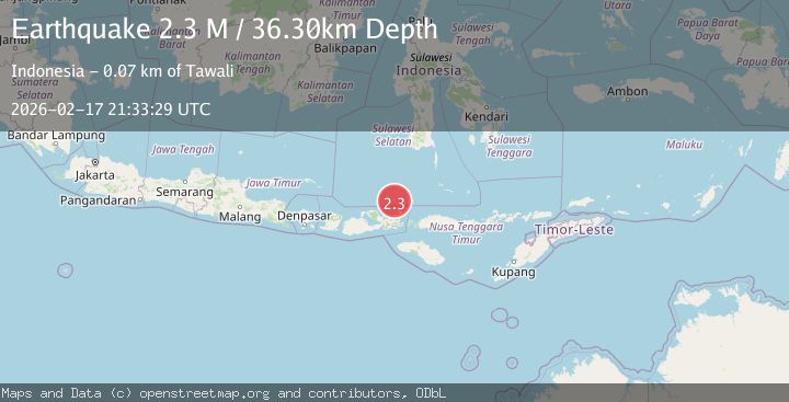
A 2.3 magnitude earthquake struck on Flores Sea, at Tue, 17 Feb 2026 21:33:29 GMT. Depth: 36.29974km. Reviewed by BMKG seismologists, this minor quake occurred at a magnitude type of M.
Magnitude
2.3
M
Source
BMKG
Intensity
-
Agency Reports
1 Sources| Source | Magnitude | Depth | Time |
|---|---|---|---|
| BMKGPrimary | 2.3 | 36 km | 13 hours ago |
Earthquake Details
ManualEvent IDbmg2026djni
Tsunami PotentialNo
Magnitude TypeM
Nearest Places
- Desa Sangiang55.0 km
- Pulau Sangeang55.1 km
- Gunungapi55.2 km
- Gunung Api55.6 km
- Tanjung Ambalawi58.6 km
Comments
Join the discussion about this event.
Latest Earthquakes
2.4Mag
Bali Region, Indonesia
Time13 hours ago
Depth10.00 km
SourceBMKG
3.0Mag
Tarapaca, Chile
Time13 hours ago
Depth100.83 km
SourceVYT (Automatic)
2.1Mag
Sumbawa Region, Indonesia
Time13 hours ago
Depth10.00 km
SourceBMKG
3.3Mag
West Papua Region, Indonesia
Time13 hours ago
Depth10.00 km
SourceBMKG
2.4Mag
Java, Indonesia
Time13 hours ago
Depth14.70 km
SourceBMKG
Nearby Earthquakes
2.8Mag
FLORES SEA
Time1 month ago
Depth34.00 km
SourceBMKG (Automatic)
2.2Mag
Flores Sea
Time13 hours ago
Depth28.79 km
SourceBMKG
2.5Mag
FLORES SEA
Time1 month ago
Depth24.00 km
SourceBMKG (Automatic)
3.0Mag
FLORES SEA
Time8 months ago
Depth21.00 km
SourceBMKG (Automatic)
2.5Mag
FLORES SEA
Time1 month ago
Depth35.00 km
SourceBMKG (Automatic)