Earthquake Halmahera, Indonesia
Tue, 17 Feb 2026 23:48:59 GMT
Time12 hours ago
Location
1.0757, 128.9582
Depth
227.3 KM
Event Summary
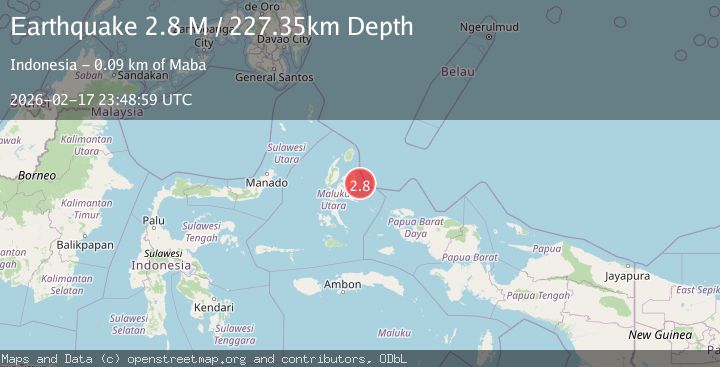
A 2.8 magnitude earthquake struck on Halmahera, Indonesia, at Tue, 17 Feb 2026 23:48:59 GMT. Depth: 227.346695km. Reviewed by BMKG seismologists, this minor quake occurred at a magnitude type of M.
Magnitude
2.8
M
Source
BMKG
Intensity
-
Agency Reports
1 Sources| Source | Magnitude | Depth | Time |
|---|---|---|---|
| BMKGPrimary | 2.8 | 227 km | 12 hours ago |
Earthquake Details
ManualEvent IDbmg2026djrv
Tsunami PotentialNo
Magnitude TypeM
Nearest Places
- Karang Saisal26.8 km
- Tanjung Wayamli28.8 km
- Teluk Kekewe29.6 km
- Sosolat30.0 km
- Air Sosolat30.0 km
Comments
Join the discussion about this event.
Latest Earthquakes
2.4Mag
Kodiak Island region, Alaska
Time12 hours ago
Depth54.08 km
SourceVYT (Automatic)
1.9Mag
Central Alaska
Time12 hours ago
Depth173.71 km
SourceVYT (Automatic)
3.4Mag
Halmahera, Indonesia
Time12 hours ago
Depth144.90 km
SourceVYT (Automatic)
1.6Mag
36 km NW of Mentone, Texas
Time12 hours ago
Depth9.77 km
SourceUSGS (Automatic)
2.0Mag
Pyrenees
Time12 hours ago
Depth0.00 km
SourceVYT (Automatic)
Nearby Earthquakes
3.0Mag
HALMAHERA, INDONESIA
Time1 year ago
Depth25.00 km
SourceBMKG (Automatic)
4.0Mag
HALMAHERA, INDONESIA
Time3 years ago
Depth10.00 km
SourceDJA (Automatic)
3.0Mag
HALMAHERA, INDONESIA
Time2 years ago
Depth10.00 km
SourceDJA (Automatic)
3.0Mag
HALMAHERA, INDONESIA
Time11 months ago
Depth10.00 km
SourceBMKG (Automatic)
3.1Mag
HALMAHERA, INDONESIA
Time1 month ago
Depth8.00 km
SourceBMKG (Automatic)