Earthquake West Papua Region, Indonesia
Wed, 18 Feb 2026 10:24:34 GMT
Time1 hour ago
Location
-2.0736, 135.6381
Depth
10.0 KM
Event Summary
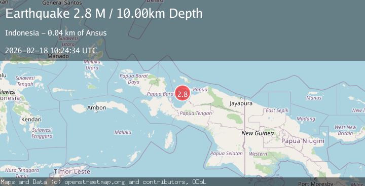
A 2.8 magnitude earthquake struck on West Papua Region, Indonesia, at Wed, 18 Feb 2026 10:24:34 GMT. Depth: 10km. Reviewed by BMKG seismologists, this minor quake occurred at a magnitude type of M.
Magnitude
2.8
M
Source
BMKG
Intensity
-
Agency Reports
1 Sources| Source | Magnitude | Depth | Time |
|---|---|---|---|
| BMKGPrimary | 2.8 | 10 km | 1 hour ago |
Earthquake Details
ManualEvent IDbmg2026dkmu
Tsunami PotentialNo
Magnitude TypeM
Nearest Places
- Numarai10.7 km
- Sarera Basin24.9 km
- Pulau Bawei28.8 km
- Pulau-pulau Kuran28.8 km
- Koruati29.0 km
Comments
Join the discussion about this event.
Latest Earthquakes
2.8Mag
Java, Indonesia
Time1 hour ago
Depth12.47 km
SourceBMKG
2.6Mag
HALMAHERA, INDONESIA
Time2 hours ago
Depth16.00 km
SourceBMKG (Automatic)
2.9Mag
Southern Molucca Sea
Time2 hours ago
Depth170.58 km
SourceBMKG
2.4Mag
WESTERN TURKEY
Time2 hours ago
Depth5.40 km
SourceKOERI (Automatic)
3.2Mag
northern Colombia
Time2 hours ago
Depth140.50 km
SourceVYT (Automatic)
Nearby Earthquakes
2.9Mag
NEAR N COAST OF PAPUA, INDONESIA
Time1 week ago
Depth10.00 km
SourceBMKG (Automatic)
5.1Mag
BIAK REGION, INDONESIA
Time7 years ago
Depth10.00 km
SourceEMSC (Automatic)
3.0Mag
BIAK REGION, INDONESIA
Time7 months ago
Depth10.00 km
SourceBMKG (Automatic)
5.2Mag
NEAR N COAST OF PAPUA, INDONESIA
Time13 years ago
Depth10.00 km
SourceEMSC (Automatic)
3.0Mag
BIAK REGION, INDONESIA
Time7 months ago
Depth10.00 km
SourceBMKG (Automatic)