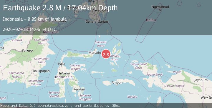
Earthquake Northern Molucca Sea
Wed, 18 Feb 2026 14:06:54 GMT
Time1 hour ago
Location
0.8815, 126.5211
Depth
17.0 KM
Event Summary
A 2.8 magnitude earthquake struck on Northern Molucca Sea, at Wed, 18 Feb 2026 14:06:54 GMT. Depth: 17.037455km. Reviewed by BMKG seismologists, this minor quake occurred at a magnitude type of M.
Magnitude
2.8
M
Source
BMKG
Intensity
-
Agency Reports
1 Sources| Source | Magnitude | Depth | Time |
|---|---|---|---|
| BMKGPrimary | 2.8 | 17 km | 1 hour ago |
Earthquake Details
ManualEvent IDbmg2026dkuc
Tsunami PotentialNo
Magnitude TypeM
Nearest Places
- Kelurahan Tifure42.9 km
- Pulau Gureda43.2 km
- Pulau Tifore43.5 km
- Kelurahan Pantai Sagu44.1 km
- Ternate Trough45.4 km
Comments
Join the discussion about this event.
Latest Earthquakes
2.4Mag
Fox Islands, Aleutian Islands, Alaska
Time1 hour ago
Depth1.22 km
SourceVYT (Automatic)
2.8Mag
Flores region, Indonesia
Time1 hour ago
Depth190.67 km
SourceVYT (Automatic)
2.8Mag
Poland
Time1 hour ago
Depth10.50 km
SourceVYT (Automatic)
1.3Mag
CENTRAL TURKEY
Time1 hour ago
Depth7.00 km
SourceAFAD (Automatic)
2.1Mag
Northern Sumatra, Indonesia
Time1 hour ago
Depth65.56 km
SourceBMKG
Nearby Earthquakes
3.1Mag
Northern Molucca Sea
Time3 weeks ago
Depth27.94 km
SourceBMKG (Automatic)
3.0Mag
MOLUCCA SEA
Time5 years ago
Depth39.00 km
SourceDJA (Automatic)
3.0Mag
MOLUCCA SEA
Time4 years ago
Depth10.00 km
SourceDJA (Automatic)
3.0Mag
Northern Molucca Sea
Time3 weeks ago
Depth25.04 km
SourceBMKG (Automatic)
5.2Mag
MOLUCCA SEA
Time15 years ago
Depth100.00 km
SourceEMSC (Automatic)