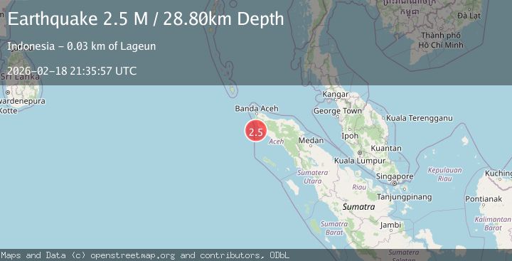
Earthquake Northern Sumatra, Indonesia
Wed, 18 Feb 2026 21:35:59 GMT
Time1 hour ago
Location
4.6199, 95.4187
Depth
27.8 KM
Event Summary
A 2.3 magnitude earthquake struck on Northern Sumatra, Indonesia, at Wed, 18 Feb 2026 21:35:59 GMT. Depth: 27.835073km. Reviewed by BMKG seismologists, this minor quake occurred at a magnitude type of M.
Magnitude
2.3
M
Source
BMKG
Intensity
-
Agency Reports
1 Sources| Source | Magnitude | Depth | Time |
|---|---|---|---|
| BMKGPrimary | 2.3 | 28 km | 1 hour ago |
Earthquake Details
ManualEvent IDbmg2026dlix
Tsunami PotentialNo
Magnitude TypeM
Nearest Places
- Pulau Rangas11.4 km
- Pulau Peureuleng12.7 km
- Pulua-pulau Cikem13.6 km
- Pulau Ranggah13.8 km
- Ujung Glumpang13.9 km
Comments
Join the discussion about this event.
Latest Earthquakes
0.5Mag
Southern Alaska
Time1 hour ago
Depth0.00 km
SourceVYT (Automatic)
3.8Mag
Tarapaca, Chile
Time1 hour ago
Depth93.51 km
SourceVYT (Automatic)
2.5Mag
Ceram Sea
Time1 hour ago
Depth3.27 km
SourceBMKG
2.1Mag
Halmahera, Indonesia
Time1 hour ago
Depth4.45 km
SourceBMKG
3.4Mag
Talaud Islands, Indonesia
Time1 hour ago
Depth98.99 km
SourceBMKG
Nearby Earthquakes
5.0Mag
NORTHERN SUMATRA, INDONESIA
Time20 years ago
Depth58.00 km
SourceEMSC (Automatic)
3.0Mag
NORTHERN SUMATRA, INDONESIA
Time1 month ago
Depth41.00 km
SourceBMKG (Automatic)
5.3Mag
NORTHERN SUMATRA, INDONESIA
Time20 years ago
Depth60.00 km
SourceEMSC (Automatic)
3.0Mag
Northern Sumatra, Indonesia
Time2 weeks ago
Depth50.37 km
SourceBMKG (Automatic)
5.2Mag
NORTHERN SUMATRA, INDONESIA
Time4 years ago
Depth63.00 km
SourceEMSC (Automatic)