Earthquake Near North Coast of West Papua
Thu, 19 Feb 2026 14:32:03 GMT
Time2 hours ago
Location
-2.3039, 140.0501
Depth
11.1 KM
Event Summary
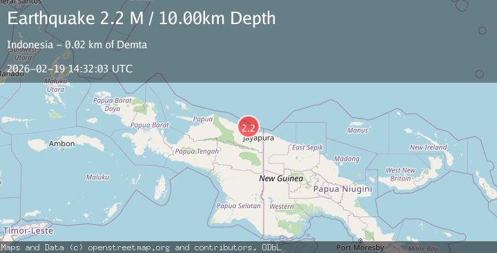
A 2.1 magnitude earthquake struck on Near North Coast of West Papua, at Thu, 19 Feb 2026 14:32:03 GMT. Depth: 11.103777km. Reviewed by BMKG seismologists, this minor quake occurred at a magnitude type of M.
Magnitude
2.1
M
Source
BMKG
Intensity
-
Agency Reports
1 Sources| Source | Magnitude | Depth | Time |
|---|---|---|---|
| BMKGPrimary | 2.1 | 11 km | 2 hours ago |
Earthquake Details
ManualEvent IDbmg2026dmqk
Tsunami PotentialNo
Magnitude TypeM
Nearest Places
- Moaif5.1 km
- Tarfia5.6 km
- Wai Humbei6.3 km
- Sungai Grime6.5 km
- Sungai Moaif7.1 km
Comments
Join the discussion about this event.
Latest Earthquakes
3.4Mag
southern Peru
Time2 hours ago
Depth204.47 km
SourceVYT (Automatic)
2.1Mag
SAN FRANCISCO BAY AREA, CALIF.
Time2 hours ago
Depth6.40 km
SourceNC (Automatic)
2.4Mag
Fox Islands, Aleutian Islands, Alaska
Time2 hours ago
Depth44.43 km
SourceVYT (Automatic)
2.4Mag
British Columbia, Canada
Time2 hours ago
Depth3.91 km
SourceVYT (Automatic)
2.0Mag
SWITZERLAND
Time2 hours ago
Depth0.10 km
SourceETHZ (Automatic)
Nearby Earthquakes
3.0Mag
NEAR N COAST OF PAPUA, INDONESIA
Time1 year ago
Depth10.00 km
SourceBMKG (Automatic)
2.7Mag
Near North Coast of West Papua
Time1 week ago
Depth10.00 km
SourceBMKG
3.0Mag
NEAR N COAST OF PAPUA, INDONESIA
Time5 months ago
Depth17.00 km
SourceBMKG (Automatic)
3.0Mag
NEAR N COAST OF PAPUA, INDONESIA
Time5 years ago
Depth10.00 km
SourceDJA (Automatic)
2.5Mag
NEAR N COAST OF PAPUA, INDONESIA
Time1 month ago
Depth22.00 km
SourceBMKG (Automatic)