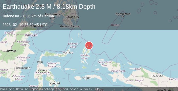
Earthquake Halmahera, Indonesia
Thu, 19 Feb 2026 23:52:41 GMT
Time3 hours ago
Location
2.6868, 128.5119
Depth
21.2 KM
Event Summary
A 2.8 magnitude earthquake struck on Halmahera, Indonesia, at Thu, 19 Feb 2026 23:52:41 GMT. Depth: 21.248089km. Reviewed by BMKG seismologists, this minor quake occurred at a magnitude type of M.
Magnitude
2.8
M
Source
BMKG
Intensity
-
Agency Reports
1 Sources| Source | Magnitude | Depth | Time |
|---|---|---|---|
| BMKGPrimary | 2.8 | 21 km | 3 hours ago |
Earthquake Details
ManualEvent IDbmg2026dnix
Tsunami PotentialNo
Magnitude TypeM
Nearest Places
- Kakaibabao7.7 km
- Tanjung Sopi7.8 km
- Tanjung Modiu8.7 km
- Teluk Sopi10.2 km
- Tanjung Padangi11.2 km
Comments
Join the discussion about this event.
Latest Earthquakes
3.0Mag
Java, Indonesia
Time3 hours ago
Depth0.00 km
SourceVYT (Automatic)
2.0Mag
Antofagasta, Chile
Time3 hours ago
Depth99.73 km
SourceVYT (Automatic)
2.5Mag
Halmahera, Indonesia
Time3 hours ago
Depth15.07 km
SourceBMKG
3.2Mag
Talaud Islands, Indonesia
Time3 hours ago
Depth10.00 km
SourceBMKG
1.9Mag
Poland
Time3 hours ago
Depth10.01 km
SourceVYT (Automatic)
Nearby Earthquakes
5.2Mag
HALMAHERA, INDONESIA
Time15 years ago
Depth40.00 km
SourceEMSC (Automatic)
3.3Mag
HALMAHERA, INDONESIA
Time1 month ago
Depth200.00 km
SourceBMKG (Automatic)
5.0Mag
HALMAHERA, INDONESIA
Time15 years ago
Depth242.00 km
SourceEMSC (Automatic)
4.0Mag
HALMAHERA, INDONESIA
Time6 years ago
Depth20.00 km
SourceDJA (Automatic)
4.0Mag
HALMAHERA, INDONESIA
Time1 year ago
Depth213.00 km
SourceBMKG (Automatic)