Earthquake Timor Region
Fri, 20 Feb 2026 07:51:37 GMT
Time2 hours ago
Location
-9.5081, 124.2888
Depth
78.8 KM
Event Summary
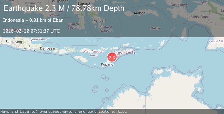
A 2.3 magnitude earthquake struck on Timor Region, at Fri, 20 Feb 2026 07:51:37 GMT. Depth: 78.775002km. Reviewed by BMKG seismologists, this minor quake occurred at a magnitude type of M.
Magnitude
2.3
M
Source
BMKG
Intensity
-
Agency Reports
1 Sources| Source | Magnitude | Depth | Time |
|---|---|---|---|
| BMKGPrimary | 2.3 | 79 km | 2 hours ago |
Earthquake Details
ManualEvent IDbmg2026dnys
Tsunami PotentialNo
Magnitude TypeM
Nearest Places
- Desa Manusasi0.3 km
- Manusasi0.6 km
- Faefsoso1.2 km
- Tubu Bijaesoenam1.3 km
- Tubu Faefsoso1.4 km
Comments
Join the discussion about this event.
Latest Earthquakes
2.2Mag
Sweden
Time2 hours ago
Depth0.00 km
SourceVYT (Automatic)
1.0Mag
11 km NE of Yucaipa, CA
Time2 hours ago
Depth7.69 km
SourceUSGS (Automatic)
2.9Mag
Timor Sea
Time2 hours ago
Depth348.75 km
SourceVYT (Automatic)
3.9Mag
Ceram Sea, Indonesia
Time2 hours ago
Depth0.00 km
SourceVYT (Automatic)
2.0Mag
Unimak Island region, Alaska
Time2 hours ago
Depth32.10 km
SourceVYT (Automatic)
Nearby Earthquakes
2.7Mag
Timor Region
Time1 week ago
Depth18.65 km
SourceBMKG (Automatic)
3.7Mag
TIMOR REGION
Time1 month ago
Depth10.00 km
SourceBMKG (Automatic)
3.0Mag
TIMOR REGION
Time3 years ago
Depth10.00 km
SourceDJA (Automatic)
2.5Mag
TIMOR REGION
Time1 month ago
Depth60.00 km
SourceBMKG (Automatic)
2.6Mag
TIMOR REGION
Time1 month ago
Depth63.00 km
SourceBMKG (Automatic)