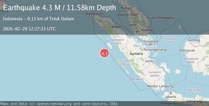
Earthquake Southwest of Sumatra, Indonesia
Fri, 20 Feb 2026 12:27:13 GMT
Time1 hour ago
Location
-0.0697, 96.8229
Depth
11.6 KM
Event Summary
A 4.3 magnitude earthquake struck on Southwest of Sumatra, Indonesia, at Fri, 20 Feb 2026 12:27:13 GMT. Depth: 11.579976km. Reviewed by BMKG seismologists, this light quake occurred at a magnitude type of M.
Magnitude
4.3
M
Source
BMKG
Intensity
-
Agency Reports
1 Sources| Source | Magnitude | Depth | Time |
|---|---|---|---|
| BMKGPrimary | 4.3 | 12 km | 1 hour ago |
Earthquake Details
ManualEvent IDbmg2026dohu
Tsunami PotentialNo
Magnitude TypeM
Nearest Places
- Desa Silina113.8 km
- Erohulo114.2 km
- Desa Gobo Baru114.3 km
- Tanjung Obotokofa114.3 km
- Balojasa114.8 km
Comments
Join the discussion about this event.
Latest Earthquakes
5.0Mag
southwest of Sumatra, Indonesia
Time1 hour ago
Depth10.00 km
SourceVYT (Automatic)
3.3Mag
Jujuy, Argentina
Time1 hour ago
Depth295.78 km
SourceVYT (Automatic)
3.0Mag
Texas-Chihuahua border region
Time1 hour ago
Depth0.00 km
SourceVYT (Automatic)
3.1Mag
Antofagasta, Chile
Time1 hour ago
Depth123.29 km
SourceVYT (Automatic)
1.3Mag
4 km W of Lake Henshaw, CA
Time1 hour ago
Depth11.95 km
SourceUSGS (Automatic)
Nearby Earthquakes
3.4Mag
SOUTHWEST OF SUMATRA, INDONESIA
Time1 month ago
Depth13.00 km
SourceBMKG (Automatic)
5.3Mag
NIAS REGION, INDONESIA
Time20 years ago
Depth33.00 km
SourceEMSC (Automatic)
5.2Mag
SOUTHWEST OF SUMATRA, INDONESIA
Time7 years ago
Depth10.00 km
SourceEMSC (Automatic)
5.0Mag
SOUTHWEST OF SUMATRA, INDONESIA
Time4 years ago
Depth10.00 km
SourceNEIC (Automatic)
4.0Mag
NIAS REGION, INDONESIA
Time1 year ago
Depth10.00 km
SourceBMKG (Automatic)