Earthquake West Papua Region, Indonesia
Fri, 20 Feb 2026 15:26:38 GMT
Time1 hour ago
Location
-2.5080, 134.9817
Depth
10.0 KM
Event Summary
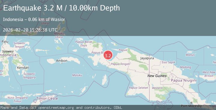
A 3.2 magnitude earthquake struck on West Papua Region, Indonesia, at Fri, 20 Feb 2026 15:26:38 GMT. Depth: 10km. Reviewed by BMKG seismologists, this minor quake occurred at a magnitude type of M.
Magnitude
3.2
M
Source
BMKG
Intensity
-
Agency Reports
1 Sources| Source | Magnitude | Depth | Time |
|---|---|---|---|
| BMKGPrimary | 3.2 | 10 km | 1 hour ago |
Earthquake Details
ManualEvent IDbmg2026dons
Tsunami PotentialNo
Magnitude TypeM
Nearest Places
- Pulau Kabuai9.8 km
- Pulau Rorebo13.2 km
- Pulau Angrameos27.2 km
- Pulau Kuwom29.6 km
- Pasir Nabadi33.9 km
Comments
Join the discussion about this event.
Latest Earthquakes
3.3Mag
Sumba region, Indonesia
Time1 hour ago
Depth17.09 km
SourceVYT (Automatic)
1.4Mag
Southeastern Alaska
Time1 hour ago
Depth0.00 km
SourceVYT (Automatic)
3.1Mag
ANTOFAGASTA, CHILE
Time1 hour ago
Depth194.50 km
SourceCSN (Automatic)
2.4Mag
Central California
Time1 hour ago
Depth0.00 km
SourceVYT (Automatic)
1.0Mag
6 km NW of The Geysers, CA
Time1 hour ago
Depth2.64 km
SourceUSGS (Automatic)
Nearby Earthquakes
3.3Mag
NEAR N COAST OF PAPUA, INDONESIA
Time1 month ago
Depth10.00 km
SourceBMKG (Automatic)
4.0Mag
NEAR N COAST OF PAPUA, INDONESIA
Time1 year ago
Depth63.00 km
SourceBMKG (Automatic)
3.0Mag
NEAR N COAST OF PAPUA, INDONESIA
Time4 years ago
Depth13.00 km
SourceDJA (Automatic)
2.7Mag
NEAR N COAST OF PAPUA, INDONESIA
Time1 month ago
Depth103.00 km
SourceBMKG (Automatic)
5.2Mag
NEAR N COAST OF PAPUA, INDONESIA
Time13 years ago
Depth10.00 km
SourceEMSC (Automatic)