Earthquake Sumba Region, Indonesia
Fri, 20 Feb 2026 16:18:42 GMT
Time1 hour ago
Location
-9.0302, 120.1327
Depth
15.4 KM
Event Summary
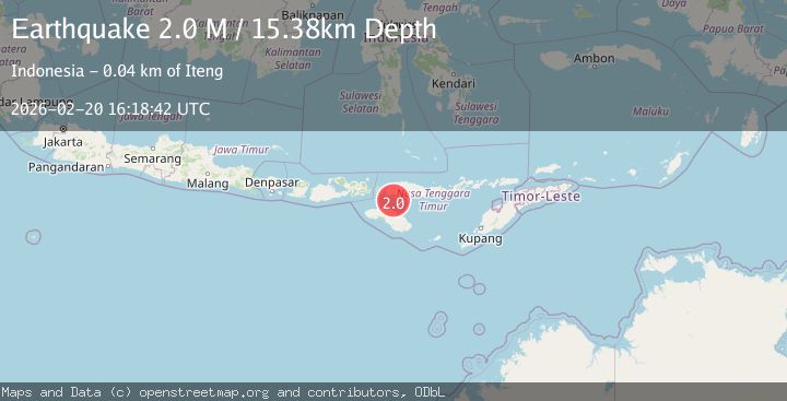
A 2.0 magnitude earthquake struck on Sumba Region, Indonesia, at Fri, 20 Feb 2026 16:18:42 GMT. Depth: 15.383221km. Reviewed by BMKG seismologists, this minor quake occurred at a magnitude type of M.
Magnitude
2.0
M
Source
BMKG
Intensity
-
Agency Reports
1 Sources| Source | Magnitude | Depth | Time |
|---|---|---|---|
| BMKGPrimary | 2.0 | 15 km | 1 hour ago |
Earthquake Details
ManualEvent IDbmg2026dopl
Tsunami PotentialNo
Magnitude TypeM
Nearest Places
- Lesser Sunda Islands15.0 km
- Toro Ontokiu19.4 km
- Desa Nuca Molas22.5 km
- Pulau Mules22.6 km
- Tanjung Denungnakeng23.3 km
Comments
Join the discussion about this event.
Latest Earthquakes
1.8Mag
Southern Alaska
Time1 hour ago
Depth80.44 km
SourceVYT (Automatic)
2.5Mag
western Texas
Time1 hour ago
Depth16.24 km
SourceVYT (Automatic)
3.1Mag
OFFSHORE ATACAMA, CHILE
Time1 hour ago
Depth39.20 km
SourceCSN (Automatic)
2.1Mag
Central Alaska
Time1 hour ago
Depth117.07 km
SourceVYT (Automatic)
3.6Mag
Banda Sea
Time1 hour ago
Depth116.58 km
SourceVYT (Automatic)
Nearby Earthquakes
3.0Mag
FLORES REGION, INDONESIA
Time8 months ago
Depth10.00 km
SourceBMKG (Automatic)
2.8Mag
Sumba Region, Indonesia
Time1 day ago
Depth8.80 km
SourceBMKG
2.2Mag
Flores Region, Indonesia
Time2 weeks ago
Depth10.00 km
SourceBMKG (Automatic)
3.0Mag
SUMBA REGION, INDONESIA
Time3 months ago
Depth12.00 km
SourceBMKG (Automatic)
3.0Mag
SUMBA REGION, INDONESIA
Time2 years ago
Depth12.00 km
SourceDJA (Automatic)