Earthquake West Papua Region, Indonesia
Sun, 22 Feb 2026 02:07:39 GMT
Time1 hour ago
Location
-1.6139, 133.8790
Depth
15.3 KM
Event Summary
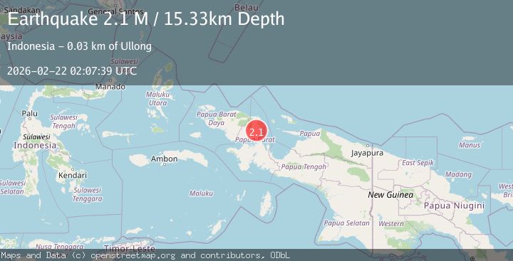
A 2.1 magnitude earthquake struck on West Papua Region, Indonesia, at Sun, 22 Feb 2026 02:07:39 GMT. Depth: 15.334971km. Reviewed by BMKG seismologists, this minor quake occurred at a magnitude type of M.
Magnitude
2.1
M
Source
BMKG
Intensity
-
Agency Reports
1 Sources| Source | Magnitude | Depth | Time |
|---|---|---|---|
| BMKGPrimary | 2.1 | 15 km | 1 hour ago |
Earthquake Details
ManualEvent IDbmg2026drej
Tsunami PotentialNo
Magnitude TypeM
Nearest Places
- 2.0 km
- 2.8 km
- 4.2 km
- 4.7 km
- 5.4 km
Comments
Join the discussion about this event.
Latest Earthquakes
1.9Mag
Tarapaca, Chile
Time1 hour ago
Depth26.49 km
SourceVYT (Automatic)
3.0Mag
Antofagasta, Chile
Time1 hour ago
Depth130.86 km
SourceVYT (Automatic)
1.1Mag
2 km N of The Geysers, CA
Time1 hour ago
Depth0.78 km
SourceUSGS (Automatic)
2.1Mag
11 km WNW of Seldovia, Alaska
Time1 hour ago
Depth51.30 km
SourceUSGS (Automatic)
2.0Mag
Antofagasta, Chile
Time1 hour ago
Depth17.82 km
SourceVYT (Automatic)
Nearby Earthquakes
5.0Mag
PAPUA, INDONESIA
Time6 years ago
Depth45.00 km
SourceEMSC (Automatic)
3.0Mag
PAPUA, INDONESIA
Time5 years ago
Depth10.00 km
SourceDJA (Automatic)
3.0Mag
PAPUA, INDONESIA
Time3 years ago
Depth25.00 km
SourceDJA (Automatic)
4.5Mag
West Papua Region, Indonesia
Time2 weeks ago
Depth20.81 km
SourceBMKG (Automatic)
2.3Mag
West Papua Region, Indonesia
Time2 weeks ago
Depth10.00 km
SourceBMKG (Automatic)