Earthquake West Papua Region, Indonesia
Wed, 04 Feb 2026 17:04:11 GMT
Time1 hour ago
Location
-1.6097, 133.6921
Depth
10.0 KM
Event Summary
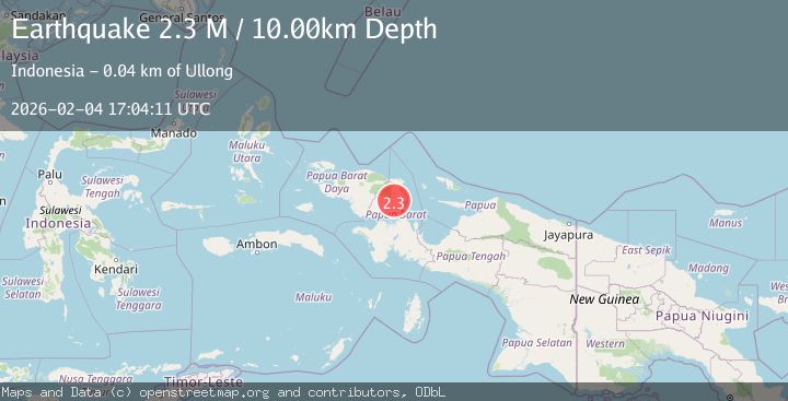
A 2.3 magnitude earthquake struck on West Papua Region, Indonesia, at Wed, 04 Feb 2026 17:04:11 GMT. Depth: 10km. Reviewed by BMKG seismologists, this minor quake occurred at a magnitude type of M.
Magnitude
2.3
M
Source
BMKG
Intensity
-
Agency Reports
1 Sources| Source | Magnitude | Depth | Time |
|---|---|---|---|
| BMKGPrimary | 2.3 | 10 km | 1 hour ago |
Earthquake Details
AutomaticEvent IDbmg2026clkx
Tsunami PotentialNo
Magnitude TypeM
Nearest Places
- Horna3.4 km
- Mindermes3.5 km
- Desra3.7 km
- Sungai Tuum4.0 km
- Kampung Mindermes4.2 km
Comments
Join the discussion about this event.
Latest Earthquakes
2.5Mag
NEAR S.E. COAST OF AUSTRALIA
Time1 hour ago
Depth3.00 km
SourceAUST (Automatic)
2.3Mag
Sulawesi, Indonesia
Time1 hour ago
Depth5.00 km
SourceBMKG (Automatic)
1.4Mag
16 km NW of Midland, Texas
Time2 hours ago
Depth5.84 km
SourceUSGS (Automatic)
3.6Mag
GUATEMALA
Time2 hours ago
Depth2.00 km
SourceINET (Automatic)
4.0Mag
Banda Sea
Time2 hours ago
Depth272.05 km
SourceBMKG (Automatic)
Nearby Earthquakes
4.5Mag
West Papua Region, Indonesia
Time1 day ago
Depth20.81 km
SourceBMKG (Automatic)
2.9Mag
West Papua Region, Indonesia
Time3 days ago
Depth10.00 km
SourceBMKG (Automatic)
2.1Mag
West Papua Region, Indonesia
Time3 days ago
Depth10.00 km
SourceBMKG (Automatic)
2.1Mag
West Papua Region, Indonesia
Time1 week ago
Depth38.83 km
SourceBMKG (Automatic)
4.2Mag
West Papua Region, Indonesia
Time3 days ago
Depth13.60 km
SourceBMKG (Automatic)