Earthquake West Papua Region, Indonesia
Sun, 22 Feb 2026 04:43:56 GMT
Time1 hour ago
Location
-4.8345, 133.8007
Depth
22.3 KM
Event Summary
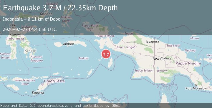
A 3.7 magnitude earthquake struck on West Papua Region, Indonesia, at Sun, 22 Feb 2026 04:43:56 GMT. Depth: 22.347324km. Reviewed by BMKG seismologists, this minor quake occurred at a magnitude type of M.
Magnitude
3.7
M
Source
BMKG
Intensity
-
Agency Reports
1 Sources| Source | Magnitude | Depth | Time |
|---|---|---|---|
| BMKGPrimary | 3.7 | 22 km | 1 hour ago |
Earthquake Details
ManualEvent IDbmg2026drjn
Tsunami PotentialNo
Magnitude TypeM
Nearest Places
- 28.7 km
- 65.3 km
- 67.0 km
- 77.3 km
- 81.0 km
Comments
Join the discussion about this event.
Latest Earthquakes
1.9Mag
southern Peru
Time1 hour ago
Depth156.98 km
SourceVYT (Automatic)
2.2Mag
Antofagasta, Chile
Time1 hour ago
Depth148.56 km
SourceVYT (Automatic)
2.0Mag
DODECANESE IS.-TURKEY BORDER REG
Time1 hour ago
Depth5.60 km
SourceKOERI (Automatic)
2.5Mag
Sumbawa region, Indonesia
Time1 hour ago
Depth121.70 km
SourceVYT (Automatic)
2.7Mag
Sumbawa Region, Indonesia
Time1 hour ago
Depth10.63 km
SourceBMKG
Nearby Earthquakes
3.7Mag
West Papua Region, Indonesia
Time3 weeks ago
Depth29.83 km
SourceBMKG (Automatic)
6.0Mag
NEAR S COAST OF PAPUA, INDONESIA
Time15 years ago
Depth2.00 km
SourceEMSC (Automatic)
5.7Mag
NEAR S COAST OF PAPUA, INDONESIA
Time2 years ago
Depth10.00 km
SourceEMSC (Automatic)
5.6Mag
NEAR S COAST OF PAPUA, INDONESIA
Time14 years ago
Depth10.00 km
SourceEMSC (Automatic)
5.0Mag
NEAR S COAST OF PAPUA, INDONESIA
Time13 years ago
Depth14.00 km
SourceEMSC (Automatic)