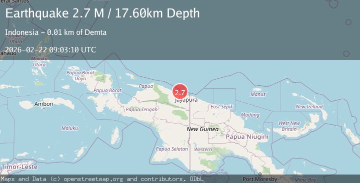
Earthquake Near North Coast of West Papua
Sun, 22 Feb 2026 09:03:09 GMT
Time1 hour ago
Location
-2.4709, 140.1339
Depth
45.1 KM
Event Summary
A 2.4 magnitude earthquake struck on Near North Coast of West Papua, at Sun, 22 Feb 2026 09:03:09 GMT. Depth: 45.05415km. Reviewed by BMKG seismologists, this minor quake occurred at a magnitude type of M.
Magnitude
2.4
M
Source
BMKG
Intensity
-
Agency Reports
1 Sources| Source | Magnitude | Depth | Time |
|---|---|---|---|
| BMKGPrimary | 2.4 | 45 km | 1 hour ago |
Earthquake Details
ManualEvent IDbmg2026drsc
Tsunami PotentialNo
Magnitude TypeM
Nearest Places
- 2.7 km
- 3.8 km
- 6.7 km
- 6.8 km
- 7.1 km
Comments
Join the discussion about this event.
Latest Earthquakes
2.6Mag
West Papua Region, Indonesia
Time1 hour ago
Depth10.00 km
SourceBMKG
0.6Mag
2 km NW of The Geysers, CA
Time1 hour ago
Depth3.79 km
SourceUSGS (Automatic)
3.2Mag
Peru-Bolivia border region
Time1 hour ago
Depth139.65 km
SourceVYT (Automatic)
3.4Mag
Panama-Colombia border region
Time1 hour ago
Depth10.00 km
SourceVYT (Automatic)
3.7Mag
Minahasa, Sulawesi, Indonesia
Time1 hour ago
Depth0.00 km
SourceVYT (Automatic)
Nearby Earthquakes
4.0Mag
NEAR N COAST OF PAPUA, INDONESIA
Time6 years ago
Depth10.00 km
SourceNEIC (Automatic)
5.1Mag
NEAR N COAST OF PAPUA, INDONESIA
Time14 years ago
Depth40.00 km
SourceEMSC (Automatic)
5.1Mag
NEAR N COAST OF PAPUA, INDONESIA
Time2 years ago
Depth10.00 km
SourceEMSC (Automatic)
5.0Mag
NEAR N COAST OF PAPUA, INDONESIA
Time17 years ago
Depth2.00 km
SourceEMSC (Automatic)
5.2Mag
NEAR N COAST OF PAPUA, INDONESIA
Time7 years ago
Depth10.00 km
SourceEMSC (Automatic)