Earthquake Near North Coast of West Papua
Thu, 26 Feb 2026 03:11:22 GMT
Time1 hour ago
Location
-2.5921, 140.5821
Depth
20.7 KM
Event Summary
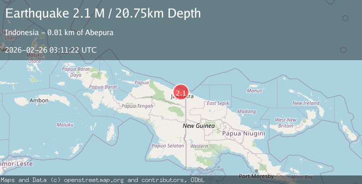
A 2.1 magnitude earthquake struck on Near North Coast of West Papua, at Thu, 26 Feb 2026 03:11:22 GMT. Depth: 20.748034km. Reviewed by BMKG seismologists, this minor quake occurred at a magnitude type of M.
Magnitude
2.1
M
Source
BMKG
Intensity
-
Agency Reports
1 Sources| Source | Magnitude | Depth | Time |
|---|---|---|---|
| BMKGPrimary | 2.1 | 21 km | 1 hour ago |
Earthquake Details
ManualEvent IDbmg2026dyom
Tsunami PotentialNo
Magnitude TypeM
Nearest Places
- 1.3 km
- 1.4 km
- 2.4 km
- 3.2 km
- 3.4 km
Comments
Join the discussion about this event.
Latest Earthquakes
3.5Mag
Antofagasta, Chile
Time54 minutes ago
Depth143.07 km
SourceVYT (Automatic)
2.5Mag
ISLAND OF HAWAII, HAWAII
Time56 minutes ago
Depth12.70 km
SourceHV (Automatic)
1.9Mag
New Mexico
Time1 hour ago
Depth2.32 km
SourceVYT (Automatic)
0.8Mag
11 km N of Borrego Springs, CA
Time1 hour ago
Depth11.52 km
SourceUSGS (Automatic)
0.9Mag
20 km NNW of San Simeon, CA
Time1 hour ago
Depth3.48 km
SourceUSGS (Automatic)
Nearby Earthquakes
5.1Mag
NEAR N COAST OF PAPUA, INDONESIA
Time3 years ago
Depth10.00 km
SourceEMSC (Automatic)
2.2Mag
Near North Coast of West Papua
Time1 month ago
Depth30.05 km
SourceBMKG (Automatic)
4.7Mag
Near North Coast of West Papua
Time1 week ago
Depth5.82 km
SourceBMKG
3.0Mag
NEAR N COAST OF PAPUA, INDONESIA
Time8 years ago
Depth10.00 km
SourceDJA (Automatic)
4.0Mag
NEAR N COAST OF PAPUA, INDONESIA
Time3 years ago
Depth10.00 km
SourceDJA (Automatic)