Earthquake Timor Region
Fri, 27 Feb 2026 12:03:15 GMT
Time21 hours ago
Location
-8.2063, 125.0845
Depth
10.0 KM
Event Summary
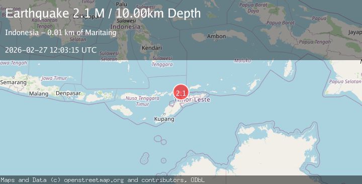
A 2.1 magnitude earthquake struck on Timor Region, at Fri, 27 Feb 2026 12:03:15 GMT. Depth: 10km. Reviewed by BMKG seismologists, this minor quake occurred at a magnitude type of M.
Magnitude
2.1
M
Source
BMKG
Intensity
-
Agency Reports
1 Sources| Source | Magnitude | Depth | Time |
|---|---|---|---|
| BMKGPrimary | 2.1 | 10 km | 21 hours ago |
Earthquake Details
ManualEvent IDbmg2026ebbn
Tsunami PotentialNo
Magnitude TypeM
Nearest Places
- 1.6 km
- 2.3 km
- 3.2 km
- 3.2 km
- 3.4 km
Comments
Join the discussion about this event.
Latest Earthquakes
2.4Mag
Bali Sea
Time21 hours ago
Depth12.42 km
SourceBMKG
3.0Mag
Potosi, Bolivia
Time21 hours ago
Depth157.59 km
SourceVYT (Automatic)
1.3Mag
7 km WSW of Anza, CA
Time21 hours ago
Depth3.41 km
SourceUSGS (Automatic)
2.7Mag
offshore Coquimbo, Chile
Time21 hours ago
Depth2.08 km
SourceVYT (Automatic)
4.9Mag
Azerbaijan
Time22 hours ago
Depth10.00 km
SourceVYT (Automatic)
Nearby Earthquakes
2.0Mag
Timor Region
Time1 month ago
Depth21.90 km
SourceBMKG (Automatic)
2.5Mag
Timor Region
Time3 weeks ago
Depth21.54 km
SourceBMKG (Automatic)
5.1Mag
EAST TIMOR REGION
Time20 years ago
Depth40.00 km
SourceEMSC (Automatic)
3.0Mag
KEPULAUAN ALOR, INDONESIA
Time2 years ago
Depth10.00 km
SourceBMKG (Automatic)
5.5Mag
EAST TIMOR REGION
Time10 years ago
Depth40.00 km
SourceEMSC (Automatic)