Earthquake West Papua Region, Indonesia
Sat, 28 Feb 2026 12:39:55 GMT
Time2 hours ago
Location
-4.0839, 133.5785
Depth
10.0 KM
Event Summary
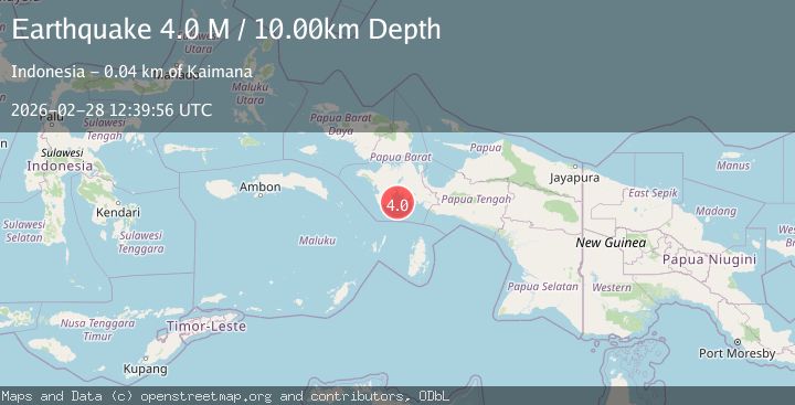
A 4.0 magnitude earthquake struck on West Papua Region, Indonesia, at Sat, 28 Feb 2026 12:39:55 GMT. Depth: 10km. Reviewed by BMKG seismologists, this light quake occurred at a magnitude type of M.
Magnitude
4.0
M
Source
BMKG
Intensity
-
Agency Reports
1 Sources| Source | Magnitude | Depth | Time |
|---|---|---|---|
| BMKGPrimary | 4.0 | 10 km | 2 hours ago |
Earthquake Details
ManualEvent IDbmg2026ecyg
Tsunami PotentialNo
Magnitude TypeM
Nearest Places
- 13.5 km
- 15.0 km
- 17.2 km
- 18.6 km
- 20.5 km
Comments
Join the discussion about this event.
Latest Earthquakes
2.6Mag
Poland-Czech Republic-Slovakia Border Region
Time2 hours ago
Depth7.81 km
SourceVYT (Automatic)
4.5Mag
offshore Coquimbo, Chile
Time2 hours ago
Depth32.35 km
SourceVYT (Automatic)
2.7Mag
Potosi, Bolivia
Time2 hours ago
Depth8.54 km
SourceVYT (Automatic)
2.8Mag
Northern Territory, Australia
Time2 hours ago
Depth27.59 km
SourceVYT (Automatic)
1.5Mag
Southern Alaska
Time2 hours ago
Depth0.00 km
SourceVYT (Automatic)
Nearby Earthquakes
4.0Mag
NEAR S COAST OF PAPUA, INDONESIA
Time5 years ago
Depth10.00 km
SourceDJA (Automatic)
3.0Mag
NEAR S COAST OF PAPUA, INDONESIA
Time2 months ago
Depth10.00 km
SourceBMKG (Automatic)
3.0Mag
NEAR S COAST OF PAPUA, INDONESIA
Time4 years ago
Depth10.00 km
SourceDJA (Automatic)
2.7Mag
West Papua Region, Indonesia
Time5 days ago
Depth91.86 km
SourceBMKG
3.9Mag
PAPUA, INDONESIA
Time1 month ago
Depth10.00 km
SourceBMKG (Automatic)