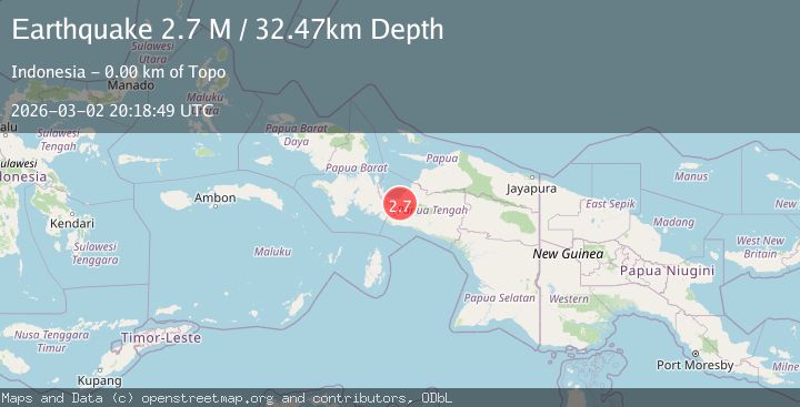
Earthquake West Papua Region, Indonesia
Mon, 02 Mar 2026 20:18:49 GMT
Time1 hour ago
Location
-3.5683, 135.5032
Depth
32.5 KM
Event Summary
A 2.7 magnitude earthquake struck on West Papua Region, Indonesia, at Mon, 02 Mar 2026 20:18:49 GMT. Depth: 32.471828km. Reviewed by BMKG seismologists, this minor quake occurred at a magnitude type of M.
Magnitude
2.7
M
Source
BMKG
Intensity
-
Agency Reports
1 Sources| Source | Magnitude | Depth | Time |
|---|---|---|---|
| BMKGPrimary | 2.7 | 32 km | 1 hour ago |
Earthquake Details
ManualEvent IDbmg2026ehek
Tsunami PotentialNo
Magnitude TypeM
Nearest Places
- 2.2 km
- 4.9 km
- 6.6 km
- 9.9 km
- 10.4 km
Comments
Join the discussion about this event.
Latest Earthquakes
2.0Mag
Java, Indonesia
Time1 hour ago
Depth39.61 km
SourceBMKG
0.4Mag
10 km WNW of The Geysers, CA
Time1 hour ago
Depth1.92 km
SourceUSGS (Automatic)
2.2Mag
Pyrenees
Time1 hour ago
Depth0.00 km
SourceVYT (Automatic)
2.4Mag
Seram, Indonesia
Time1 hour ago
Depth10.00 km
SourceBMKG
2.1Mag
NEVADA
Time1 hour ago
Depth5.90 km
SourceNN (Automatic)
Nearby Earthquakes
5.0Mag
PAPUA, INDONESIA
Time5 months ago
Depth32.00 km
SourceEMSC (Automatic)
2.6Mag
PAPUA, INDONESIA
Time1 month ago
Depth10.00 km
SourceBMKG (Automatic)
5.4Mag
PAPUA, INDONESIA
Time12 years ago
Depth10.00 km
SourceEMSC (Automatic)
5.0Mag
PAPUA, INDONESIA
Time19 years ago
Depth10.00 km
SourceEMSC (Automatic)
3.2Mag
West Papua Region, Indonesia
Time1 month ago
Depth10.00 km
SourceBMKG (Automatic)