Earthquake Minahassa Peninsula, Sulawesi
Mon, 02 Mar 2026 20:58:54 GMT
Time2 hours ago
Location
-0.7030, 123.6751
Depth
5.0 KM
Event Summary
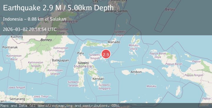
A 2.9 magnitude earthquake struck on Minahassa Peninsula, Sulawesi, at Mon, 02 Mar 2026 20:58:54 GMT. Depth: 5km. Reviewed by BMKG seismologists, this minor quake occurred at a magnitude type of M.
Magnitude
2.9
M
Source
BMKG
Intensity
-
Agency Reports
1 Sources| Source | Magnitude | Depth | Time |
|---|---|---|---|
| BMKGPrimary | 2.9 | 5 km | 2 hours ago |
Earthquake Details
ManualEvent IDbmg2026ehfs
Tsunami PotentialNo
Magnitude TypeM
Nearest Places
- 25.4 km
- 25.7 km
- 25.7 km
- 25.9 km
- 26.1 km
Comments
Join the discussion about this event.
Latest Earthquakes
4.5Mag
Rat Islands, Aleutian Islands, Alaska
Time2 hours ago
Depth10.00 km
SourceVYT (Automatic)
2.9Mag
Minahasa, Sulawesi, Indonesia
Time2 hours ago
Depth179.20 km
SourceVYT (Automatic)
1.7Mag
24 km S of Fern Forest, Hawaii
Time2 hours ago
Depth36.98 km
SourceUSGS (Automatic)
1.3Mag
8 km NW of The Geysers, CA
Time2 hours ago
Depth1.72 km
SourceUSGS (Automatic)
1.0Mag
8 km NW of The Geysers, CA
Time2 hours ago
Depth1.55 km
SourceUSGS (Automatic)
Nearby Earthquakes
2.6Mag
SULAWESI, INDONESIA
Time2 months ago
Depth3.00 km
SourceBMKG (Automatic)
3.3Mag
Minahassa Peninsula, Sulawesi
Time1 month ago
Depth10.00 km
SourceBMKG (Automatic)
3.0Mag
SULAWESI, INDONESIA
Time5 years ago
Depth15.00 km
SourceDJA (Automatic)
3.1Mag
Minahassa Peninsula, Sulawesi
Time0 months ago
Depth100.51 km
SourceBMKG (Automatic)
3.0Mag
SULAWESI, INDONESIA
Time6 months ago
Depth10.00 km
SourceBMKG (Automatic)