Earthquake 8 km NW of The Geysers, CA
Mon, 02 Mar 2026 20:54:03 GMT
Time3 hours ago
Location
38.8290, -122.8177
Depth
1.7 KM
Event Summary
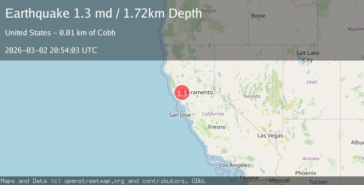
A 1.3 magnitude earthquake struck on 8 km NW of The Geysers, CA, at Mon, 02 Mar 2026 20:54:03 GMT. Depth: 1.72000002861023km. Reviewed by USGS seismologists, this minor quake occurred at a magnitude type of md.
Magnitude
1.3
md
Source
USGS
Intensity
-
Agency Reports
1 Sources| Source | Magnitude | Depth | Time |
|---|---|---|---|
| USGSPrimary | 1.3 | 2 km | 3 hours ago |
Earthquake Details
AutomaticEvent IDusgs_nc75321552
Tsunami PotentialNo
Magnitude Typemd
Nearest Places
- 0.3 km
- 0.7 km
- 1.3 km
- 1.7 km
- 2.0 km
Comments
Join the discussion about this event.
Latest Earthquakes
4.5Mag
Rat Islands, Aleutian Islands, Alaska
Time3 hours ago
Depth10.00 km
SourceVYT (Automatic)
2.9Mag
Minahassa Peninsula, Sulawesi
Time3 hours ago
Depth5.00 km
SourceBMKG
2.9Mag
Minahasa, Sulawesi, Indonesia
Time3 hours ago
Depth179.20 km
SourceVYT (Automatic)
1.7Mag
24 km S of Fern Forest, Hawaii
Time3 hours ago
Depth36.98 km
SourceUSGS (Automatic)
1.0Mag
8 km NW of The Geysers, CA
Time3 hours ago
Depth1.55 km
SourceUSGS (Automatic)
Nearby Earthquakes
2.2Mag
NORTHERN CALIFORNIA
Time1 month ago
Depth1.50 km
SourceNC (Automatic)
1.1Mag
8 km NW of The Geysers, CA
Time6 days ago
Depth1.58 km
SourceUSGS (Automatic)
0.8Mag
8 km NW of The Geysers, CA
Time3 weeks ago
Depth2.05 km
SourceUSGS (Automatic)
1.3Mag
8 km NW of The Geysers, CA
Time1 month ago
Depth1.64 km
SourceUSGS (Automatic)
1.0Mag
8 km NW of The Geysers, CA
Time2 weeks ago
Depth1.88 km
SourceUSGS (Automatic)