Earthquake Minahassa Peninsula, Sulawesi
Mon, 26 Jan 2026 08:32:51 GMT
Time1 day ago
Location
-0.7339, 123.5928
Depth
10.0 KM
Event Summary
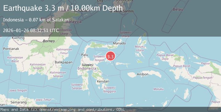
A 3.3 magnitude earthquake struck on Minahassa Peninsula, Sulawesi, at Mon, 26 Jan 2026 08:32:51 GMT. Depth: 10km. Reviewed by BMKG seismologists, this minor quake occurred at a magnitude type of M.
Magnitude
3.3
M
Source
BMKG
Intensity
-
Agency Reports
1 Sources| Source | Magnitude | Depth | Time |
|---|---|---|---|
| BMKGPrimary | 3.3 | 10 km | 1 day ago |
Earthquake Details
AutomaticEvent IDbmg2026buim
Tsunami PotentialNo
Magnitude TypeM
Nearest Places
- Tanjung Talabu15.6 km
- Tanjung Batutete16.5 km
- Tanjung Ui16.6 km
- Tanjung Ui16.7 km
- Toku17.2 km
Comments
Join the discussion about this event.
Latest Earthquakes
1.1Mag
30 km NE of Los Alamos, CA
Time9 minutes ago
Depth4.17 km
SourceUSGS (Automatic)
1.2Mag
EASTERN TURKEY
Time9 minutes ago
Depth7.00 km
SourceAFAD (Automatic)
2.6Mag
Timor Region
Time12 minutes ago
Depth35.26 km
SourceBMKG (Automatic)
2.3Mag
Sumbawa Region, Indonesia
Time12 minutes ago
Depth10.00 km
SourceBMKG (Automatic)
2.5Mag
Flores Sea
Time13 minutes ago
Depth26.93 km
SourceBMKG (Automatic)
Nearby Earthquakes
3.7Mag
Minahassa Peninsula, Sulawesi
Time1 day ago
Depth10.00 km
SourceBMKG (Automatic)
4.3Mag
Minahassa Peninsula, Sulawesi
Time1 day ago
Depth10.00 km
SourceBMKG (Automatic)
2.9Mag
Minahassa Peninsula, Sulawesi
Time1 day ago
Depth5.00 km
SourceBMKG (Automatic)
2.8Mag
Minahassa Peninsula, Sulawesi
Time4 days ago
Depth18.33 km
SourceBMKG (Automatic)
3.0Mag
Minahassa Peninsula, Sulawesi
Time2 days ago
Depth55.68 km
SourceBMKG (Automatic)