Earthquake Northern Sumatra, Indonesia
Thu, 05 Mar 2026 07:42:11 GMT
Time13 hours ago
Location
4.1967, 97.5921
Depth
26.5 KM
Event Summary
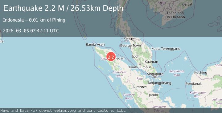
A 2.2 magnitude earthquake struck on Northern Sumatra, Indonesia, at Thu, 05 Mar 2026 07:42:11 GMT. Depth: 26.529423km. Reviewed by BMKG seismologists, this minor quake occurred at a magnitude type of M.
Magnitude
2.2
M
Source
BMKG
Intensity
-
Agency Reports
1 Sources| Source | Magnitude | Depth | Time |
|---|---|---|---|
| BMKGPrimary | 2.2 | 27 km | 13 hours ago |
Earthquake Details
ManualEvent IDbmg2026elry
Tsunami PotentialNo
Magnitude TypeM
Nearest Places
- 2.0 km
- 2.1 km
- 2.2 km
- 2.4 km
- 3.3 km
Comments
Join the discussion about this event.
Latest Earthquakes
2.7Mag
offshore Atacama, Chile
Time6 hours ago
Depth28.32 km
SourceVYT (Automatic)
2.6Mag
Sulawesi, Indonesia
Time6 hours ago
Depth0.00 km
SourceVYT (Automatic)
2.3Mag
Southeastern Alaska
Time6 hours ago
Depth3.05 km
SourceVYT (Automatic)
3.3Mag
Sunda Strait, Indonesia
Time6 hours ago
Depth47.36 km
SourceVYT (Automatic)
1.4Mag
10 km NW of Anza, CA
Time7 hours ago
Depth15.60 km
SourceUSGS (Automatic)
Nearby Earthquakes
3.1Mag
northern Sumatra, Indonesia
Time1 week ago
Depth0.00 km
SourceVYT (Automatic)
3.7Mag
northern Sumatra, Indonesia
Time3 days ago
Depth7.93 km
SourceVYT (Automatic)
2.7Mag
Northern Sumatra, Indonesia
Time2 weeks ago
Depth1.00 km
SourceBMKG
4.0Mag
Northern Sumatra, Indonesia
Time2 weeks ago
Depth10.00 km
SourceBMKG
3.3Mag
northern Sumatra, Indonesia
Time1 week ago
Depth0.00 km
SourceVYT (Automatic)