Earthquake SOUTHERN CALIFORNIA
Tue, 06 Jan 2026 12:44:52 GMT
Time3 days ago
Location
32.9282, -116.2993
Depth
8.4 KM
Event Summary
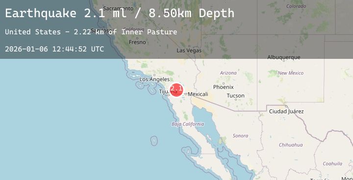
A 2.2 magnitude earthquake struck on SOUTHERN CALIFORNIA, at Tue, 06 Jan 2026 12:44:52 GMT. Depth: 8.4km. Reviewed by SCSN seismologists, this minor quake occurred at a magnitude type of ml.
Magnitude
2.2
ml
Source
SCSN
Intensity
-
Agency Reports
1 Sources| Source | Magnitude | Depth | Time |
|---|---|---|---|
| SCSNPrimary | 2.2 | 8 km | 3 days ago |
Earthquake Details
AutomaticEvent IDemsc_20260106_0000227
Tsunami PotentialNo
Magnitude Typeml
Nearest Places
- Inner Pasture2.2 km
- Moonlight Canyon2.3 km
- Agua Caliente Springs2.4 km
- Agua Caliente County Park2.7 km
- Squaw Canyon2.7 km
Comments
Join the discussion about this event.
Latest Earthquakes
2.3Mag
Java, Indonesia
Time3 days ago
Depth21.67 km
SourceBMKG (Automatic)
1.8Mag
15 km NE of Chase, Alaska
Time3 days ago
Depth9.40 km
SourceUSGS (Automatic)
2.0Mag
Sumbawa Region, Indonesia
Time3 days ago
Depth119.47 km
SourceBMKG (Automatic)
2.6Mag
West Papua Region, Indonesia
Time3 days ago
Depth10.00 km
SourceBMKG (Automatic)
3.1Mag
SOUTHERN GREECE
Time3 days ago
Depth5.00 km
SourceNOA (Automatic)
Nearby Earthquakes
1.5Mag
6 km W of Ocotillo, CA
Time3 days ago
Depth8.66 km
SourceUSGS (Automatic)
0.8Mag
6 km WSW of Anza, CA
Time3 days ago
Depth3.65 km
SourceUSGS (Automatic)
2.0Mag
5 km SSW of Idyllwild, CA
Time4 days ago
Depth16.34 km
SourceUSGS (Automatic)
1.2Mag
6 km WSW of Anza, CA
Time4 days ago
Depth4.15 km
SourceUSGS (Automatic)
0.7Mag
8 km SW of Idyllwild, CA
Time4 days ago
Depth14.29 km
SourceUSGS (Automatic)