Earthquake 6 km WSW of Anza, CA
Mon, 05 Jan 2026 21:22:32 GMT
Time3 days ago
Location
33.5300, -116.7313
Depth
4.2 KM
Event Summary
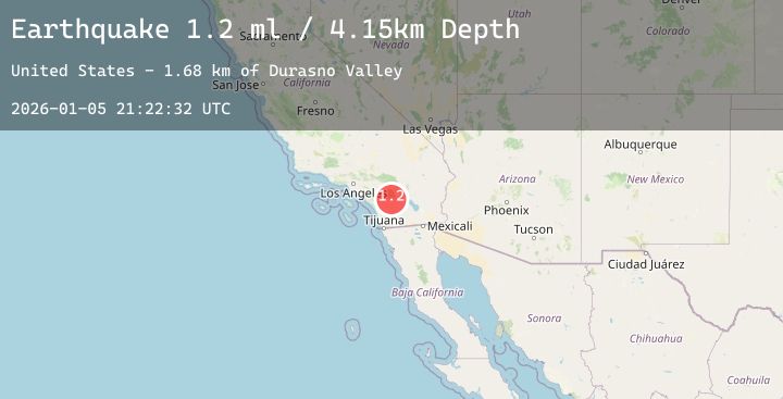
A 1.2 magnitude earthquake struck on 6 km WSW of Anza, CA, at Mon, 05 Jan 2026 21:22:32 GMT. Depth: 4.15000009536743km. Reviewed by USGS seismologists, this minor quake occurred at a magnitude type of ml.
Magnitude
1.2
ml
Source
USGS
Intensity
-
Agency Reports
2 Sources| Source | Magnitude | Depth | Time |
|---|---|---|---|
| USGSPrimary | 1.0 | 4 km | 3 days ago |
| USGSPrimary | 1.2 | 17 km | 3 days ago |
Earthquake Details
AutomaticEvent IDusgs_ci41152551
Tsunami PotentialNo
Magnitude Typeml
Nearest Places
- Durasno Valley1.7 km
- Cahuilla1.7 km
- Cahuilla Reservation2.1 km
- Cave Rocks4.1 km
- Elder Canyon4.2 km
Comments
Join the discussion about this event.
Latest Earthquakes
3.2Mag
Southwest of Sumatra, Indonesia
Time3 days ago
Depth10.00 km
SourceBMKG (Automatic)
3.4Mag
OFF E. COAST OF N. ISLAND, N.Z.
Time3 days ago
Depth33.00 km
SourceGNS (Automatic)
2.3Mag
53 km NW of Tatitlek, Alaska
Time3 days ago
Depth11.80 km
SourceUSGS (Automatic)
3.0Mag
Near North Coast of West Papua
Time3 days ago
Depth15.44 km
SourceBMKG (Automatic)
3.4Mag
NEAR S COAST OF PAPUA, INDONESIA
Time3 days ago
Depth97.00 km
SourceBMKG (Automatic)
Nearby Earthquakes
0.7Mag
8 km SW of Idyllwild, CA
Time3 days ago
Depth14.29 km
SourceUSGS (Automatic)
2.1Mag
SOUTHERN CALIFORNIA
Time3 days ago
Depth8.50 km
SourceSCSN (Automatic)
1.1Mag
19 km N of Borrego Springs, CA
Time4 days ago
Depth5.57 km
SourceUSGS (Automatic)
1.5Mag
11 km S of Idyllwild, CA
Time4 days ago
Depth13.42 km
SourceUSGS (Automatic)
0.8Mag
18 km E of Julian, CA
Time4 days ago
Depth6.30 km
SourceUSGS (Automatic)