Earthquake PHILIPPINE ISLANDS REGION
Fri, 09 Jan 2026 18:38:25 GMT
Time2 days ago
Location
7.2600, 127.0700
Depth
13.0 KM
Event Summary
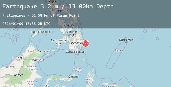
A 3.2 magnitude earthquake struck on PHILIPPINE ISLANDS REGION, at Fri, 09 Jan 2026 18:38:25 GMT. Depth: 13km. Reviewed by PIVS seismologists, this minor quake occurred at a magnitude type of m.
Magnitude
3.2
m
Source
PIVS
Intensity
-
Agency Reports
1 Sources| Source | Magnitude | Depth | Time |
|---|---|---|---|
| PIVSPrimary | 3.2 | 13 km | 2 days ago |
Earthquake Details
AutomaticEvent IDemsc_20260109_0000281
Tsunami PotentialNo
Magnitude Typem
Nearest Places
- Pusan Point51.5 km
- Caraga Bay53.8 km
- Santiago54.0 km
- Bunga Cove54.7 km
- Santiago54.9 km
Comments
Join the discussion about this event.
Latest Earthquakes
1.6Mag
10 km E of Yucaipa, CA
Time2 days ago
Depth3.55 km
SourceUSGS (Automatic)
2.3Mag
Timor Region
Time2 days ago
Depth59.57 km
SourceBMKG (Automatic)
2.4Mag
ALBANIA
Time2 days ago
Depth15.00 km
SourceIGEO (Automatic)
3.0Mag
TARAPACA, CHILE
Time2 days ago
Depth103.30 km
SourceCSN (Automatic)
1.0Mag
5 km NNW of The Geysers, CA
Time2 days ago
Depth0.95 km
SourceUSGS (Automatic)