Earthquake MYANMAR
Mon, 12 Jan 2026 13:26:14 GMT
Time12 hours ago
Location
17.9360, 96.5190
Depth
10.0 KM
Event Summary
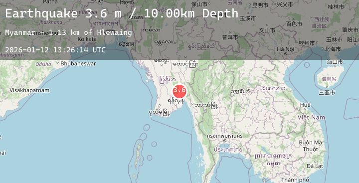
A 3.6 magnitude earthquake struck on MYANMAR, at Mon, 12 Jan 2026 13:26:14 GMT. Depth: 10km. Reviewed by TSB seismologists, this minor quake occurred at a magnitude type of m.
Magnitude
3.6
m
Source
TSB
Intensity
-
Agency Reports
1 Sources| Source | Magnitude | Depth | Time |
|---|---|---|---|
| TSBPrimary | 3.6 | 10 km | 12 hours ago |
Earthquake Details
AutomaticEvent IDemsc_20260112_0000194
Tsunami PotentialNo
Magnitude Typem
Nearest Places
- Hlewaing1.1 km
- Okshitkon2.2 km
- Thabyegin3.1 km
- Yelè3.2 km
- Padimyaung3.5 km
Comments
Join the discussion about this event.
Latest Earthquakes
2.1Mag
Sumbawa Region, Indonesia
Time12 hours ago
Depth21.71 km
SourceBMKG (Automatic)
1.3Mag
2 km NW of Universal City, CA
Time12 hours ago
Depth14.15 km
SourceUSGS (Automatic)
2.9Mag
Minahassa Peninsula, Sulawesi
Time12 hours ago
Depth261.21 km
SourceBMKG (Automatic)
2.8Mag
TARAPACA, CHILE
Time12 hours ago
Depth107.10 km
SourceCSN (Automatic)
2.5Mag
West Papua Region, Indonesia
Time12 hours ago
Depth13.47 km
SourceBMKG (Automatic)
Nearby Earthquakes
No significant earthquakes nearby recently.