Earthquake PHILIPPINE ISLANDS REGION
Thu, 15 Jan 2026 19:50:07 GMT
Time4 hours ago
Location
6.2400, 127.3200
Depth
28.0 KM
Event Summary
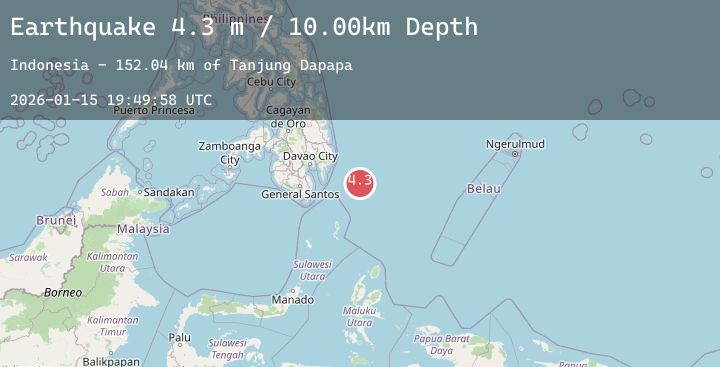
A 4.7 magnitude earthquake struck on PHILIPPINE ISLANDS REGION, at Thu, 15 Jan 2026 19:50:07 GMT. Depth: 28km. Reviewed by BMKG seismologists, this light quake occurred at a magnitude type of m.
Magnitude
4.7
m
Source
BMKG
Intensity
-
Agency Reports
2 Sources| Source | Magnitude | Depth | Time |
|---|---|---|---|
| BMKGPrimary | 4.3 | 28 km | 4 hours ago |
| USGS | 4.7 | 10 km | 4 hours ago |
Earthquake Details
AutomaticEvent IDemsc_20260115_0000301
Tsunami PotentialNo
Magnitude Typem
Nearest Places
- Tanjung Dapapa110.3 km
- Desa Pulau Miangas111.3 km
- Pulau Miangas111.3 km
- Kecamatan Miangas111.3 km
- Miangas112.1 km
Comments
Join the discussion about this event.
Latest Earthquakes
2.1Mag
Bali Region, Indonesia
Time4 hours ago
Depth82.92 km
SourceBMKG (Automatic)
1.6Mag
52 km WNW of Ninilchik, Alaska
Time4 hours ago
Depth102.90 km
SourceUSGS (Automatic)
2.0Mag
Sumbawa Region, Indonesia
Time4 hours ago
Depth26.94 km
SourceBMKG (Automatic)
1.6Mag
CENTRAL TURKEY
Time4 hours ago
Depth6.90 km
SourceAFAD (Automatic)
1.6Mag
10 km NNE of Talmage, CA
Time4 hours ago
Depth0.67 km
SourceUSGS (Automatic)
Nearby Earthquakes
No significant earthquakes nearby recently.