Earthquake 52 km WNW of Ninilchik, Alaska
Thu, 15 Jan 2026 20:02:14 GMT
Time3 hours ago
Location
60.2230, -152.5500
Depth
102.9 KM
Event Summary
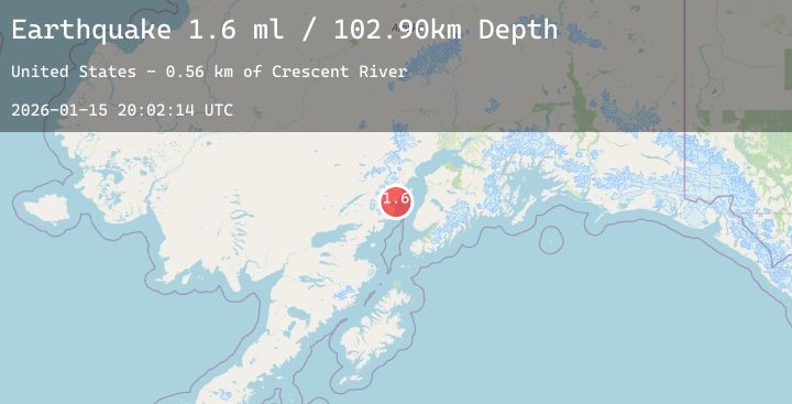
A 1.6 magnitude earthquake struck on 52 km WNW of Ninilchik, Alaska, at Thu, 15 Jan 2026 20:02:14 GMT. Depth: 102.9km. Reviewed by USGS seismologists, this minor quake occurred at a magnitude type of ml.
Magnitude
1.6
ml
Source
USGS
Intensity
-
Agency Reports
1 Sources| Source | Magnitude | Depth | Time |
|---|---|---|---|
| USGSPrimary | 1.6 | 103 km | 3 hours ago |
Earthquake Details
AutomaticEvent IDusgs_ak2026bbgaip
Tsunami PotentialNo
Magnitude Typeml
Nearest Places
- Crescent River0.6 km
- Squarehead Cove6.3 km
- Tuxedni National Wildlife Refuge7.9 km
- Polly Creek8.0 km
- Duck Island8.3 km
Comments
Join the discussion about this event.
Latest Earthquakes
2.1Mag
17 km E of Ferry, Alaska
Time39 minutes ago
Depth5.00 km
SourceUSGS (Automatic)
1.0Mag
8 km WNW of Cobb, CA
Time40 minutes ago
Depth1.86 km
SourceUSGS (Automatic)
2.5Mag
Northern Sumatra, Indonesia
Time44 minutes ago
Depth21.04 km
SourceBMKG (Automatic)
2.0Mag
Flores Sea
Time48 minutes ago
Depth10.96 km
SourceBMKG (Automatic)
1.9Mag
17 km NW of North Las Vegas, Nevada
Time51 minutes ago
Depth15.94 km
SourceUSGS (Automatic)
Nearby Earthquakes
2.3Mag
32 km W of Happy Valley, Alaska
Time6 hours ago
Depth72.80 km
SourceUSGS (Automatic)
2.3Mag
57 km WNW of Happy Valley, Alaska
Time8 hours ago
Depth121.80 km
SourceUSGS (Automatic)
2.6Mag
50 km ENE of Pedro Bay, Alaska
Time11 hours ago
Depth147.90 km
SourceUSGS (Automatic)
1.9Mag
50 km ESE of Pedro Bay, Alaska
Time17 hours ago
Depth106.20 km
SourceUSGS (Automatic)
2.2Mag
32 km WNW of Ninilchik, Alaska
Time19 hours ago
Depth73.90 km
SourceUSGS (Automatic)