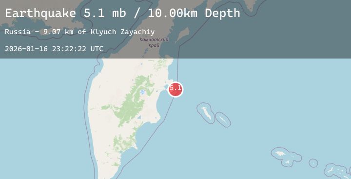
Earthquake NEAR EAST COAST OF KAMCHATKA
Fri, 16 Jan 2026 23:22:24 GMT
Time4 hours ago
Location
56.5336, 163.1539
Depth
35.0 KM
Event Summary
A 5.2 magnitude earthquake struck on NEAR EAST COAST OF KAMCHATKA, at Fri, 16 Jan 2026 23:22:24 GMT. Depth: 35km. Reviewed by NEIC seismologists, this moderate quake occurred at a magnitude type of mw.
Magnitude
5.2
mw
Source
NEIC
Intensity
-
Agency Reports
2 Sources| Source | Magnitude | Depth | Time |
|---|---|---|---|
| NEICPrimary | 5.2 | 35 km | 4 hours ago |
| USGS | 5.2 | 35 km | 4 hours ago |
Earthquake Details
AutomaticEvent IDemsc_20260116_0000386
Tsunami PotentialNo
Magnitude Typemw
Nearest Places
- Klyuch Kultuchnyy3.6 km
- Klyuch Dvoynoy3.7 km
- Urochishche Chetvërtaya Perevalka3.7 km
- Ozero Gornoye4.3 km
- Kultuchnaya4.3 km
Comments
Join the discussion about this event.
Latest Earthquakes
1.7Mag
16 km NNE of Summerlin South, Nevada
Time4 hours ago
Depth2.61 km
SourceUSGS (Automatic)
5.2Mag
Seram, Indonesia
Time4 hours ago
Depth74.35 km
SourceBMKG (Automatic)
0.7Mag
8 km NW of The Geysers, CA
Time4 hours ago
Depth1.55 km
SourceUSGS (Automatic)
3.8Mag
NEAR WEST COAST OF HONSHU, JAPAN
Time4 hours ago
Depth10.00 km
SourceJMA (Automatic)
2.2Mag
Northern Sumatra, Indonesia
Time4 hours ago
Depth0.99 km
SourceBMKG (Automatic)
Nearby Earthquakes
No significant earthquakes nearby recently.