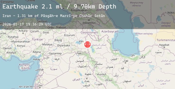
Earthquake TURKEY-IRAN BORDER REGION
Sat, 17 Jan 2026 19:36:29 GMT
Time4 hours ago
Location
38.3165, 44.5112
Depth
9.7 KM
Event Summary
A 2.1 magnitude earthquake struck on TURKEY-IRAN BORDER REGION, at Sat, 17 Jan 2026 19:36:29 GMT. Depth: 9.7km. Reviewed by KOERI seismologists, this minor quake occurred at a magnitude type of ml.
Magnitude
2.1
ml
Source
KOERI
Intensity
-
Agency Reports
1 Sources| Source | Magnitude | Depth | Time |
|---|---|---|---|
| KOERIPrimary | 2.1 | 10 km | 4 hours ago |
Earthquake Details
AutomaticEvent IDemsc_20260117_0000227
Tsunami PotentialNo
Magnitude Typeml
Nearest Places
- Pāsgāh-e Marzī-ye Chahār Sotūn1.3 km
- Deshvān1.9 km
- Borūshkhūrān3.8 km
- Kūh-e Qolleh Gūzīk4.2 km
- Kūh-e Shūr Bolāgh4.2 km
Comments
Join the discussion about this event.
Latest Earthquakes
0.9Mag
3 km NW of The Geysers, CA
Time4 hours ago
Depth3.56 km
SourceUSGS (Automatic)
2.1Mag
Sunda Strait, Indonesia
Time4 hours ago
Depth37.81 km
SourceBMKG (Automatic)
2.9Mag
GUATEMALA
Time4 hours ago
Depth1.00 km
SourceINET (Automatic)
3.0Mag
Northern Molucca Sea
Time4 hours ago
Depth85.43 km
SourceBMKG (Automatic)
1.5Mag
98 km NNW of Karluk, Alaska
Time4 hours ago
Depth5.00 km
SourceUSGS (Automatic)
Nearby Earthquakes
No significant earthquakes nearby recently.