Earthquake TURKEY-IRAN BORDER REGION
Sat, 17 Jan 2026 19:36:27 GMT
Time1 month ago
Location
38.4742, 44.5764
Depth
7.0 KM
Event Summary
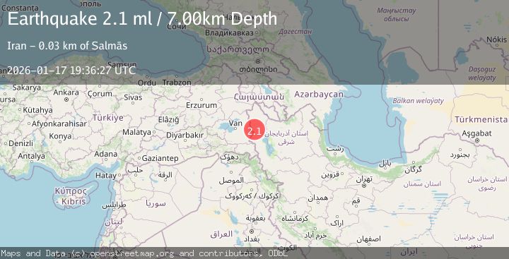
A 2.1 magnitude earthquake struck on TURKEY-IRAN BORDER REGION, at Sat, 17 Jan 2026 19:36:27 GMT. Depth: 7km. Reviewed by AFAD seismologists, this minor quake occurred at a magnitude type of ml.
Magnitude
2.1
ml
Source
AFAD
Intensity
-
Agency Reports
1 Sources| Source | Magnitude | Depth | Time |
|---|---|---|---|
| AFADPrimary | 2.1 | 7 km | 1 month ago |
Earthquake Details
AutomaticEvent IDemsc_AFAD_20260117_0000227
Tsunami PotentialNo
Magnitude Typeml
Nearest Places
- Kūh-e Yarvash2.5 km
- Chālyān3.5 km
- Gūgerd3.6 km
- Kūh-e Qajarlī3.6 km
- Zerī3.8 km
Comments
Join the discussion about this event.
Latest Earthquakes
3.7Mag
Kepulauan Tanimbar, Indonesia
Time10 minutes ago
Depth10.00 km
SourceVYT (Automatic)
4.6Mag
West Papua Region, Indonesia
Time10 minutes ago
Depth24.86 km
SourceBMKG
1.5Mag
35 km SE of Minto, Alaska
Time14 minutes ago
Depth0.10 km
SourceUSGS (Automatic)
3.7Mag
Banda Sea
Time14 minutes ago
Depth237.55 km
SourceVYT (Automatic)
2.2Mag
AEGEAN SEA
Time15 minutes ago
Depth12.80 km
SourceKOERI (Automatic)
Nearby Earthquakes
3.0Mag
TURKEY-IRAN BORDER REGION
Time5 years ago
Depth2.00 km
SourceEMSC (Automatic)
3.0Mag
TURKEY-IRAN BORDER REGION
Time10 years ago
Depth2.00 km
SourceEMSC (Automatic)
2.5Mag
TURKEY-IRAN BORDER REGION
Time1 month ago
Depth8.10 km
SourceEMSC (Automatic)
3.0Mag
TURKEY-IRAN BORDER REGION
Time18 years ago
Depth4.00 km
SourceEMSC (Automatic)
4.0Mag
TURKEY-IRAN BORDER REGION
Time6 years ago
Depth2.00 km
SourceEMSC (Automatic)