Earthquake WESTERN AUSTRALIA
Wed, 20 Jan 2016 09:40:50 GMT
Time10 years ago
Location
-29.3400, 116.6100
Depth
8.0 KM
Event Summary
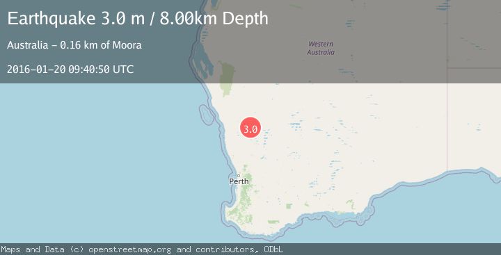
A 3.0 magnitude earthquake struck on WESTERN AUSTRALIA, at Wed, 20 Jan 2016 09:40:50 GMT. Depth: 8km. Reviewed by AUST seismologists, this minor quake occurred at a magnitude type of m.
Magnitude
3.0
m
Source
AUST
Intensity
-
Agency Reports
1 Sources| Source | Magnitude | Depth | Time |
|---|---|---|---|
| AUSTPrimary | 3.0 | 8 km | 10 years ago |
Earthquake Details
AutomaticEvent IDemsc_AUST_20160120_0000076
Tsunami PotentialNo
Magnitude Typem
Nearest Places
- Mulla Well2.5 km
- Howson Well4.6 km
- Peter Well5.5 km
- Salty Bore5.7 km
- Camel Soak7.0 km
Comments
Join the discussion about this event.
Latest Earthquakes
2.7Mag
Western Australia
Time2 hours ago
Depth485.47 km
SourceVYT (Automatic)
3.8Mag
Sumba region, Indonesia
Time2 hours ago
Depth127.93 km
SourceVYT (Automatic)
2.7Mag
Minahasa, Sulawesi, Indonesia
Time2 hours ago
Depth201.29 km
SourceVYT (Automatic)
4.2Mag
Talaud Islands, Indonesia
Time2 hours ago
Depth750.00 km
SourceBMKG
3.8Mag
Kenai Peninsula, Alaska
Time2 hours ago
Depth49.93 km
SourceVYT (Automatic)
Nearby Earthquakes
3.0Mag
WESTERN AUSTRALIA
Time10 years ago
Depth2.00 km
SourceAUST (Automatic)
3.0Mag
WESTERN AUSTRALIA
Time10 years ago
Depth2.00 km
SourceAUST (Automatic)
3.0Mag
WESTERN AUSTRALIA
Time1 year ago
Depth3.00 km
SourceAUST (Automatic)
3.0Mag
WESTERN AUSTRALIA
Time9 years ago
Depth2.00 km
SourceAUST (Automatic)
2.7Mag
Western Australia
Time2 hours ago
Depth485.47 km
SourceVYT (Automatic)