Earthquake NORTHWEST OF AUSTRALIA
Thu, 22 Jan 2026 18:03:59 GMT
Time2 weeks ago
Location
-18.5900, 118.4600
Depth
10.0 KM
Event Summary
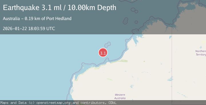
A 3.1 magnitude earthquake struck on NORTHWEST OF AUSTRALIA, at Thu, 22 Jan 2026 18:03:59 GMT. Depth: 10km. Reviewed by AUST seismologists, this minor quake occurred at a magnitude type of ml.
Magnitude
3.1
ml
Source
AUST
Intensity
-
Agency Reports
1 Sources| Source | Magnitude | Depth | Time |
|---|---|---|---|
| AUSTPrimary | 3.1 | 10 km | 2 weeks ago |
Earthquake Details
AutomaticEvent IDemsc_AUST_20260122_0000325
Tsunami PotentialNo
Magnitude Typeml
Nearest Places
- Imperieuse Reef120.7 km
- Rowley Shoals Marine Park121.7 km
- Cunningham Island122.8 km
- Bedout Island Light129.5 km
- Bedout Island129.8 km
Comments
Join the discussion about this event.
Latest Earthquakes
2.0Mag
20 km WNW of Sunnyside-Tahoe City, CA
Time3 minutes ago
Depth-1.58 km
SourceUSGS (Automatic)
0.7Mag
13 km ENE of Cloverdale, CA
Time14 minutes ago
Depth2.32 km
SourceUSGS (Automatic)
1.1Mag
11 km W of Forsan, Texas
Time15 minutes ago
Depth1.29 km
SourceUSGS (Automatic)
2.5Mag
16 km SSE of Pope-Vannoy Landing, Alaska
Time16 minutes ago
Depth14.10 km
SourceUSGS (Automatic)
2.4Mag
Sumbawa Region, Indonesia
Time17 minutes ago
Depth14.22 km
SourceBMKG
Nearby Earthquakes
3.1Mag
WESTERN AUSTRALIA
Time4 hours ago
Depth10.00 km
SourceAUST (Automatic)
2.8Mag
WESTERN AUSTRALIA
Time4 hours ago
Depth10.00 km
SourceAUST (Automatic)
3.2Mag
South of Sumbawa, Indonesia
Time1 week ago
Depth10.00 km
SourceBMKG (Automatic)
3.8Mag
South of Sumbawa, Indonesia
Time1 week ago
Depth10.00 km
SourceBMKG (Automatic)
3.1Mag
South of Sumbawa, Indonesia
Time1 week ago
Depth10.00 km
SourceBMKG (Automatic)