Earthquake WESTERN AUSTRALIA
Thu, 19 Feb 2026 10:00:47 GMT
Time3 days ago
Location
-33.8340, 117.9136
Depth
1.3 KM
Event Summary
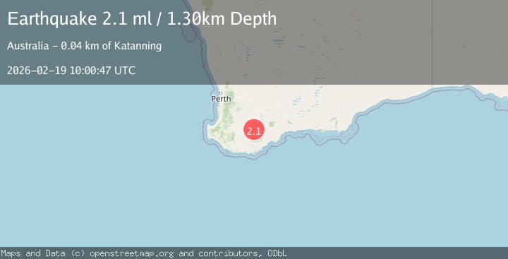
A 2.1 magnitude earthquake struck on WESTERN AUSTRALIA, at Thu, 19 Feb 2026 10:00:47 GMT. Depth: 1.3km. Reviewed by AUST seismologists, this minor quake occurred at a magnitude type of ml.
Magnitude
2.1
ml
Source
AUST
Intensity
-
Agency Reports
1 Sources| Source | Magnitude | Depth | Time |
|---|---|---|---|
| AUSTPrimary | 2.1 | 1 km | 3 days ago |
Earthquake Details
AutomaticEvent IDemsc_AUST_20260219_0000342
Tsunami PotentialNo
Magnitude Typeml
Nearest Places
- 2.4 km
- 2.9 km
- 3.0 km
- 3.0 km
- 3.6 km
Comments
Join the discussion about this event.
Latest Earthquakes
2.3Mag
Poland
Time18 hours ago
Depth0.00 km
SourceVYT (Automatic)
2.6Mag
Nevada
Time18 hours ago
Depth3.91 km
SourceVYT (Automatic)
1.1Mag
34 km E of McKinney Acres, Texas
Time18 hours ago
Depth4.22 km
SourceUSGS (Automatic)
3.0Mag
Antofagasta, Chile
Time18 hours ago
Depth141.60 km
SourceVYT (Automatic)
1.8Mag
Unimak Island region, Alaska
Time18 hours ago
Depth120.61 km
SourceVYT (Automatic)
Nearby Earthquakes
2.0Mag
WESTERN AUSTRALIA
Time5 days ago
Depth5.00 km
SourceAUST (Automatic)
2.0Mag
WESTERN AUSTRALIA
Time1 week ago
Depth5.00 km
SourceAUST (Automatic)
2.0Mag
WESTERN AUSTRALIA
Time1 week ago
Depth5.00 km
SourceAUST (Automatic)
2.2Mag
WESTERN AUSTRALIA
Time1 week ago
Depth5.00 km
SourceAUST (Automatic)
2.2Mag
WESTERN AUSTRALIA
Time2 weeks ago
Depth5.00 km
SourceAUST (Automatic)