Earthquake SOUTHERN SUMATRA, INDONESIA
Tue, 06 Jan 2026 08:28:25 GMT
Time1 month ago
Location
-0.2800, 100.1500
Depth
117.0 KM
Event Summary
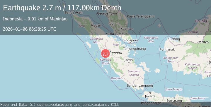
A 2.7 magnitude earthquake struck on SOUTHERN SUMATRA, INDONESIA, at Tue, 06 Jan 2026 08:28:25 GMT. Depth: 117km. Reviewed by BMKG seismologists, this minor quake occurred at a magnitude type of m.
Magnitude
2.7
m
Source
BMKG
Intensity
-
Agency Reports
1 Sources| Source | Magnitude | Depth | Time |
|---|---|---|---|
| BMKGPrimary | 2.7 | 117 km | 1 month ago |
Earthquake Details
AutomaticEvent IDemsc_BMKG_20260106_0000154
Tsunami PotentialNo
Magnitude Typem
Nearest Places
- Nagari Koto Malintang0.6 km
- Alai1.3 km
- Gunung Ampangsikikis2.5 km
- Mukomuko3.1 km
- Batukalang3.9 km
Comments
Join the discussion about this event.
Latest Earthquakes
3.2Mag
Antofagasta, Chile
Time8 hours ago
Depth149.90 km
SourceVYT (Automatic)
1.7Mag
Kenai Peninsula, Alaska
Time8 hours ago
Depth12.33 km
SourceVYT (Automatic)
2.6Mag
Halmahera, Indonesia
Time8 hours ago
Depth6.01 km
SourceBMKG
3.3Mag
Channel Islands region, California
Time8 hours ago
Depth10.00 km
SourceVYT (Automatic)
3.0Mag
Ceram Sea
Time9 hours ago
Depth13.47 km
SourceBMKG
Nearby Earthquakes
5.1Mag
SOUTHERN SUMATRA, INDONESIA
Time17 years ago
Depth121.00 km
SourceEMSC (Automatic)
2.1Mag
Southern Sumatra, Indonesia
Time1 week ago
Depth10.64 km
SourceBMKG (Automatic)
2.8Mag
SOUTHERN SUMATRA, INDONESIA
Time1 month ago
Depth4.00 km
SourceBMKG (Automatic)
2.5Mag
SOUTHERN SUMATRA, INDONESIA
Time1 month ago
Depth4.00 km
SourceBMKG (Automatic)
2.6Mag
SOUTHERN SUMATRA, INDONESIA
Time1 month ago
Depth10.00 km
SourceBMKG (Automatic)