Earthquake SUMBA REGION, INDONESIA
Wed, 07 Jan 2026 23:43:51 GMT
Time1 month ago
Location
-9.3300, 120.7600
Depth
82.0 KM
Event Summary
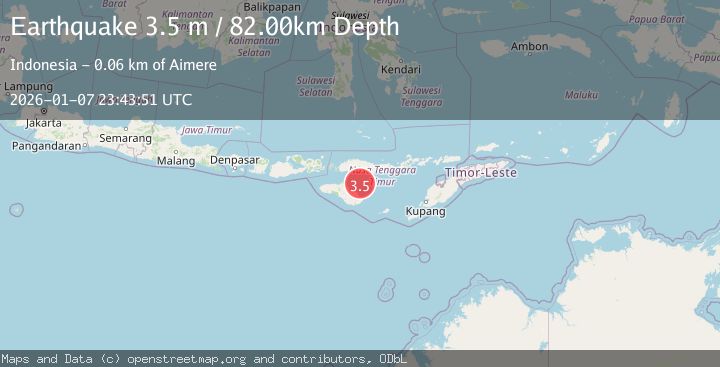
A 3.5 magnitude earthquake struck on SUMBA REGION, INDONESIA, at Wed, 07 Jan 2026 23:43:51 GMT. Depth: 82km. Reviewed by BMKG seismologists, this minor quake occurred at a magnitude type of m.
Magnitude
3.5
m
Source
BMKG
Intensity
-
Agency Reports
1 Sources| Source | Magnitude | Depth | Time |
|---|---|---|---|
| BMKGPrimary | 3.5 | 82 km | 1 month ago |
Earthquake Details
AutomaticEvent IDemsc_BMKG_20260107_0000393
Tsunami PotentialNo
Magnitude Typem
Nearest Places
- Tanjung Batuata44.0 km
- Tanjung Maujawa46.5 km
- Tanjung Lajela47.0 km
- Laipori Dua47.0 km
- Kandora47.2 km
Comments
Join the discussion about this event.
Latest Earthquakes
2.5Mag
West Papua Region, Indonesia
Time4 minutes ago
Depth12.37 km
SourceBMKG
2.6Mag
Antofagasta, Chile
Time6 minutes ago
Depth116.33 km
SourceVYT (Automatic)
1.1Mag
Northern Territory, Australia
Time8 minutes ago
Depth0.00 km
SourceVYT (Automatic)
3.7Mag
NEAR THE COAST OF WESTERN TURKEY
Time11 minutes ago
Depth8.00 km
SourceTHE (Automatic)
2.2Mag
Central Alaska
Time11 minutes ago
Depth131.71 km
SourceVYT (Automatic)
Nearby Earthquakes
3.0Mag
SUMBA REGION, INDONESIA
Time1 year ago
Depth42.00 km
SourceBMKG (Automatic)
2.2Mag
Sumba Region, Indonesia
Time3 weeks ago
Depth63.49 km
SourceBMKG (Automatic)
5.0Mag
SUMBA REGION, INDONESIA
Time13 years ago
Depth10.00 km
SourceEMSC (Automatic)
2.8Mag
SUMBA REGION, INDONESIA
Time1 month ago
Depth39.00 km
SourceBMKG (Automatic)
2.4Mag
Sumba Region, Indonesia
Time1 week ago
Depth57.80 km
SourceBMKG (Automatic)