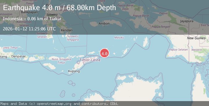
Earthquake KEPULAUAN BARAT DAYA, INDONESIA
Mon, 12 Jan 2026 11:25:06 GMT
Time1 month ago
Location
-7.8100, 128.2500
Depth
68.0 KM
Event Summary
A 4.0 magnitude earthquake struck on KEPULAUAN BARAT DAYA, INDONESIA, at Mon, 12 Jan 2026 11:25:06 GMT. Depth: 68km. Reviewed by BMKG seismologists, this light quake occurred at a magnitude type of m.
Magnitude
4.0
m
Source
BMKG
Intensity
-
Agency Reports
1 Sources| Source | Magnitude | Depth | Time |
|---|---|---|---|
| BMKGPrimary | 4.0 | 68 km | 1 month ago |
Earthquake Details
AutomaticEvent IDemsc_BMKG_20260112_0000173
Tsunami PotentialNo
Magnitude Typem
Nearest Places
- Pantai Kiera40.0 km
- Tanjung Tiokioka40.4 km
- Tanjung Wawilasun40.6 km
- Tanjung Seradona41.7 km
- Gunung Ilkierna43.0 km
Comments
Join the discussion about this event.
Latest Earthquakes
1.0Mag
Southeastern Alaska
Time6 minutes ago
Depth0.00 km
SourceVYT (Automatic)
3.5Mag
COOK STRAIT, NEW ZEALAND
Time7 minutes ago
Depth75.30 km
SourceGNS (Automatic)
2.4Mag
Seram, Indonesia
Time8 minutes ago
Depth18.42 km
SourceBMKG
2.6Mag
West Papua Region, Indonesia
Time11 minutes ago
Depth17.35 km
SourceBMKG
5.0Mag
CENTRAL MID-ATLANTIC RIDGE
Time12 minutes ago
Depth10.00 km
SourceEMSC (Automatic)
Nearby Earthquakes
5.0Mag
KEPULAUAN BARAT DAYA, INDONESIA
Time8 years ago
Depth119.00 km
SourceEMSC (Automatic)
6.5Mag
KEPULAUAN BARAT DAYA, INDONESIA
Time12 years ago
Depth138.00 km
SourceEMSC (Automatic)
4.6Mag
Banda Sea
Time1 week ago
Depth151.73 km
SourceVYT (Automatic)
5.2Mag
KEPULAUAN BARAT DAYA, INDONESIA
Time19 years ago
Depth33.00 km
SourceEMSC (Automatic)
5.0Mag
KEPULAUAN BARAT DAYA, INDONESIA
Time11 years ago
Depth189.00 km
SourceEMSC (Automatic)