Earthquake SUNDA STRAIT, INDONESIA
Mon, 12 Jan 2026 15:09:05 GMT
Time1 month ago
Location
-6.6100, 105.1600
Depth
14.0 KM
Event Summary
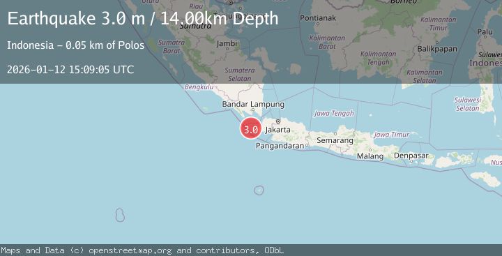
A 3.0 magnitude earthquake struck on SUNDA STRAIT, INDONESIA, at Mon, 12 Jan 2026 15:09:05 GMT. Depth: 14km. Reviewed by BMKG seismologists, this minor quake occurred at a magnitude type of m.
Magnitude
3.0
m
Source
BMKG
Intensity
-
Agency Reports
1 Sources| Source | Magnitude | Depth | Time |
|---|---|---|---|
| BMKGPrimary | 3.0 | 14 km | 1 month ago |
Earthquake Details
AutomaticEvent IDemsc_BMKG_20260112_0000223
Tsunami PotentialNo
Magnitude Typem
Nearest Places
- Teluk Sarimo1.4 km
- Ci Harahas2.7 km
- Legon Bajo2.7 km
- Legon Sabini3.1 km
- Ranca Darahayu3.1 km
Comments
Join the discussion about this event.
Latest Earthquakes
1.6Mag
Southern Alaska
Time5 minutes ago
Depth48.58 km
SourceVYT (Automatic)
2.3Mag
Antofagasta, Chile
Time7 minutes ago
Depth82.15 km
SourceVYT (Automatic)
2.1Mag
Southern Alaska
Time10 minutes ago
Depth64.21 km
SourceVYT (Automatic)
2.5Mag
Central Alaska
Time15 minutes ago
Depth312.99 km
SourceVYT (Automatic)
3.6Mag
Banda Sea
Time22 minutes ago
Depth0.00 km
SourceVYT (Automatic)
Nearby Earthquakes
2.5Mag
SUNDA STRAIT, INDONESIA
Time3 weeks ago
Depth13.00 km
SourceBMKG (Automatic)
6.1Mag
SUNDA STRAIT, INDONESIA
Time16 years ago
Depth60.00 km
SourceEMSC (Automatic)
5.1Mag
SUNDA STRAIT, INDONESIA
Time7 years ago
Depth60.00 km
SourceEMSC (Automatic)
5.2Mag
SUNDA STRAIT, INDONESIA
Time15 years ago
Depth34.00 km
SourceEMSC (Automatic)
3.0Mag
SUNDA STRAIT, INDONESIA
Time2 years ago
Depth21.00 km
SourceBMKG (Automatic)