Earthquake MOLUCCA SEA
Tue, 13 Jan 2026 00:40:29 GMT
Time1 month ago
Location
2.8900, 127.8300
Depth
112.0 KM
Event Summary
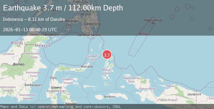
A 3.7 magnitude earthquake struck on MOLUCCA SEA, at Tue, 13 Jan 2026 00:40:29 GMT. Depth: 112km. Reviewed by BMKG seismologists, this minor quake occurred at a magnitude type of m.
Magnitude
3.7
m
Source
BMKG
Intensity
-
Agency Reports
1 Sources| Source | Magnitude | Depth | Time |
|---|---|---|---|
| BMKGPrimary | 3.7 | 112 km | 1 month ago |
Earthquake Details
AutomaticEvent IDemsc_BMKG_20260113_0000010
Tsunami PotentialNo
Magnitude Typem
Nearest Places
- Morotai Basin22.5 km
- Pulau Karis58.5 km
- Pulau Tuanane64.8 km
- Tanjung Papaye64.9 km
- Pulau Sedeng65.9 km
Comments
Join the discussion about this event.
Latest Earthquakes
1.0Mag
Southeastern Alaska
Time3 minutes ago
Depth0.00 km
SourceVYT (Automatic)
3.5Mag
COOK STRAIT, NEW ZEALAND
Time4 minutes ago
Depth75.30 km
SourceGNS (Automatic)
2.4Mag
Seram, Indonesia
Time5 minutes ago
Depth18.42 km
SourceBMKG
2.6Mag
West Papua Region, Indonesia
Time8 minutes ago
Depth17.35 km
SourceBMKG
2.8Mag
Antofagasta, Chile
Time12 minutes ago
Depth0.00 km
SourceVYT (Automatic)
Nearby Earthquakes
4.0Mag
MOLUCCA SEA
Time1 year ago
Depth141.20 km
SourceNEIC (Automatic)
4.0Mag
MOLUCCA SEA
Time6 years ago
Depth10.00 km
SourceDJA (Automatic)
5.0Mag
MOLUCCA SEA
Time10 years ago
Depth15.00 km
SourceEMSC (Automatic)
4.0Mag
MOLUCCA SEA
Time4 years ago
Depth10.00 km
SourceDJA (Automatic)
3.4Mag
Northern Molucca Sea
Time1 week ago
Depth16.72 km
SourceBMKG (Automatic)