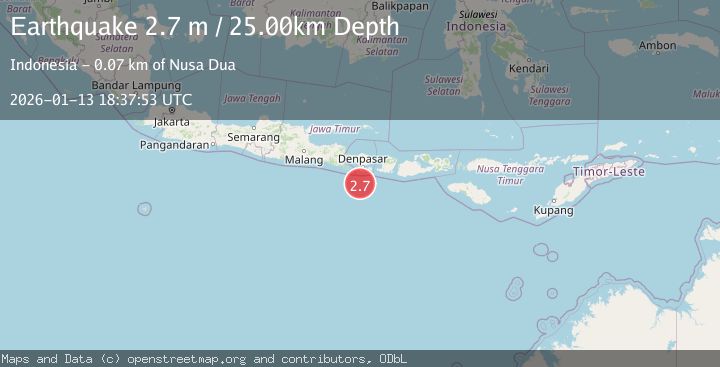
Earthquake SOUTH OF BALI, INDONESIA
Tue, 13 Jan 2026 18:37:53 GMT
Time1 month ago
Location
-9.3900, 115.1300
Depth
25.0 KM
Event Summary
A 2.7 magnitude earthquake struck on SOUTH OF BALI, INDONESIA, at Tue, 13 Jan 2026 18:37:53 GMT. Depth: 25km. Reviewed by BMKG seismologists, this minor quake occurred at a magnitude type of m.
Magnitude
2.7
m
Source
BMKG
Intensity
-
Agency Reports
1 Sources| Source | Magnitude | Depth | Time |
|---|---|---|---|
| BMKGPrimary | 2.7 | 25 km | 1 month ago |
Earthquake Details
AutomaticEvent IDemsc_BMKG_20260113_0000274
Tsunami PotentialNo
Magnitude Typem
Nearest Places
- Tukad Batukakeb60.3 km
- Tukad Jelijih60.3 km
- Tukad Kabangbukal60.4 km
- Tukad Pangpang60.4 km
- Alila Villas60.4 km
Comments
Join the discussion about this event.
Latest Earthquakes
1.5Mag
5 km NW of The Geysers, CA
Time9 hours ago
Depth2.47 km
SourceUSGS (Automatic)
0.3Mag
10 km WNW of The Geysers, CA
Time9 hours ago
Depth2.50 km
SourceUSGS (Automatic)
2.5Mag
Central Alaska
Time9 hours ago
Depth112.55 km
SourceVYT (Automatic)
2.3Mag
Antofagasta, Chile
Time9 hours ago
Depth58.47 km
SourceVYT (Automatic)
1.8Mag
AEGEAN SEA
Time9 hours ago
Depth7.00 km
SourceAFAD (Automatic)
Nearby Earthquakes
3.0Mag
SOUTH OF BALI, INDONESIA
Time1 year ago
Depth17.00 km
SourceBMKG (Automatic)
2.8Mag
South of Bali, Indonesia
Time2 weeks ago
Depth54.31 km
SourceBMKG (Automatic)
3.1Mag
SOUTH OF BALI, INDONESIA
Time1 month ago
Depth47.00 km
SourceBMKG (Automatic)
3.4Mag
SOUTH OF BALI, INDONESIA
Time0 months ago
Depth34.00 km
SourceBMKG (Automatic)
3.0Mag
SOUTH OF BALI, INDONESIA
Time10 months ago
Depth44.00 km
SourceBMKG (Automatic)