Earthquake MOLUCCA SEA
Fri, 16 Jan 2026 11:41:02 GMT
Time1 month ago
Location
1.2400, 126.7800
Depth
27.0 KM
Event Summary
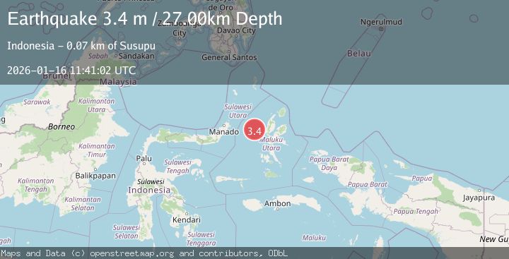
A 3.4 magnitude earthquake struck on MOLUCCA SEA, at Fri, 16 Jan 2026 11:41:02 GMT. Depth: 27km. Reviewed by BMKG seismologists, this minor quake occurred at a magnitude type of m.
Magnitude
3.4
m
Source
BMKG
Intensity
-
Agency Reports
1 Sources| Source | Magnitude | Depth | Time |
|---|---|---|---|
| BMKGPrimary | 3.4 | 27 km | 1 month ago |
Earthquake Details
AutomaticEvent IDemsc_BMKG_20260116_0000209
Tsunami PotentialNo
Magnitude Typem
Nearest Places
- Kelurahan Bido43.2 km
- Tanjung Geranomaderi44.2 km
- Pulau Mayu44.7 km
- Kecamatan Pulau Batang Dua44.8 km
- Kelurahan Lelewi44.8 km
Comments
Join the discussion about this event.
Latest Earthquakes
2.8Mag
West Papua Region, Indonesia
Time8 minutes ago
Depth34.12 km
SourceBMKG
3.6Mag
NORTHERN ALGERIA
Time15 minutes ago
Depth5.80 km
SourceIGN (Automatic)
2.6Mag
Java, Indonesia
Time18 minutes ago
Depth214.22 km
SourceBMKG
1.0Mag
Southeastern Alaska
Time18 minutes ago
Depth0.00 km
SourceVYT (Automatic)
3.5Mag
COOK STRAIT, NEW ZEALAND
Time19 minutes ago
Depth75.30 km
SourceGNS (Automatic)
Nearby Earthquakes
3.0Mag
MOLUCCA SEA
Time1 month ago
Depth16.00 km
SourceBMKG (Automatic)
2.9Mag
Northern Molucca Sea
Time2 weeks ago
Depth15.50 km
SourceBMKG (Automatic)
3.0Mag
MOLUCCA SEA
Time6 months ago
Depth15.00 km
SourceBMKG (Automatic)
3.0Mag
MOLUCCA SEA
Time10 months ago
Depth18.00 km
SourceBMKG (Automatic)
5.5Mag
MOLUCCA SEA
Time13 years ago
Depth76.00 km
SourceEMSC (Automatic)