Earthquake NORTHERN SUMATRA, INDONESIA
Sat, 17 Jan 2026 04:54:32 GMT
Time1 month ago
Location
5.4900, 95.8700
Depth
10.0 KM
Event Summary
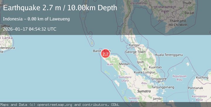
A 2.7 magnitude earthquake struck on NORTHERN SUMATRA, INDONESIA, at Sat, 17 Jan 2026 04:54:32 GMT. Depth: 10km. Reviewed by BMKG seismologists, this minor quake occurred at a magnitude type of m.
Magnitude
2.7
m
Source
BMKG
Intensity
-
Agency Reports
1 Sources| Source | Magnitude | Depth | Time |
|---|---|---|---|
| BMKGPrimary | 2.7 | 10 km | 1 month ago |
Earthquake Details
AutomaticEvent IDemsc_BMKG_20260117_0000047
Tsunami PotentialNo
Magnitude Typem
Nearest Places
- Gle Guhatujoh0.8 km
- Gampong Tgk Di Laweung1.8 km
- Cot2.1 km
- Gampong Suka Jaya2.3 km
- Kuala Sagi2.4 km
Comments
Join the discussion about this event.
Latest Earthquakes
2.1Mag
Halmahera, Indonesia
Time4 minutes ago
Depth4.45 km
SourceBMKG
3.4Mag
Talaud Islands, Indonesia
Time8 minutes ago
Depth98.99 km
SourceBMKG
2.1Mag
Flores Region, Indonesia
Time8 minutes ago
Depth165.90 km
SourceBMKG
2.4Mag
Sumbawa region, Indonesia
Time9 minutes ago
Depth19.65 km
SourceVYT (Automatic)
2.1Mag
Poland
Time12 minutes ago
Depth1.95 km
SourceVYT (Automatic)
Nearby Earthquakes
2.5Mag
northern Sumatra, Indonesia
Time1 week ago
Depth0.00 km
SourceVYT (Automatic)
5.2Mag
NORTHERN SUMATRA, INDONESIA
Time18 years ago
Depth10.00 km
SourceEMSC (Automatic)
3.0Mag
NORTHERN SUMATRA, INDONESIA
Time5 years ago
Depth10.00 km
SourceDJA (Automatic)
5.3Mag
NORTHERN SUMATRA, INDONESIA
Time21 years ago
Depth33.00 km
SourceEMSC (Automatic)
2.1Mag
Northern Sumatra, Indonesia
Time11 hours ago
Depth3.19 km
SourceBMKG